 Expert
Bump and jump with some rolling waves!
Location
Coordinates:
48.9842438, -123.0846426
If are looking for a spot to sail with more roll to the water than the north side of the Ferry Terminal, Gulf Road might be the spot for you!
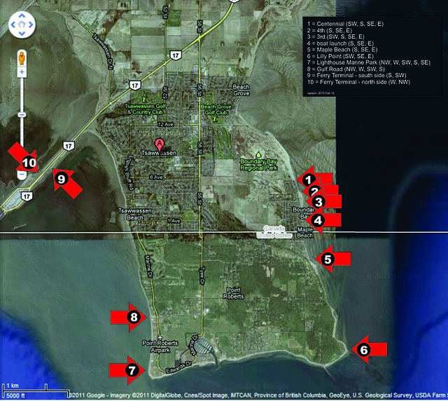
As shown on the map above, Gulf Road is one of four windsport beaches on Point Roberts – Maple Beach (5), Lilly Point (6), Lighthouse Park (7), and Gulf Road (8). This site has only been sailed recently on a small number of days so there is much to learn about it.
Directions:
- South on Highway 99
- West on South Fraser Perimeter Road (BC-17)
- South on 56 Street in Tsawwassen
- Cross the Canada-US border
- South on Tyee Road
- West on Gulf Road
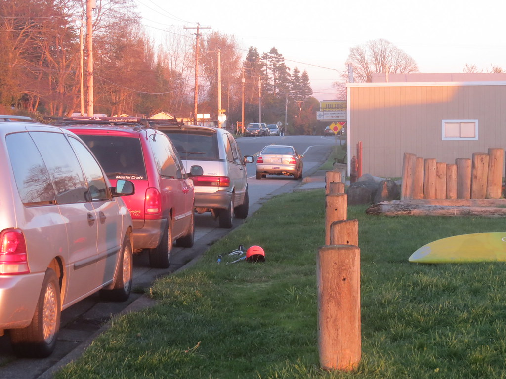
On-street parking the south side of Gulf Road west of Front Street.
Seasons/Days/Strength:
- This spot provides a great option for northwest wind, especially on those days when the wind is favouring the straight and not working at Acadia or the other beaches on Spanish Banks in Vancouver.
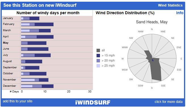
- The wind data shown above is for Sand Heads and will over represent for Gulf Road during the summer months.
- 9 months have 25 mph days (overstated for Gulf Road)
- 12 months have 20 mph days (overstated for Gulf Road)
- Spring (Jan, Feb, Mar, Apr) and fall (Sep, Oct, Nov, Dec) are fairly balanced (number of days and number of strong days)
- December has the most days, but November shows more days over 25 mph
- Southeast wind dominates, but its the northwest you want to catch here
Direction(s):
- Southeast (side offshore) through northwest (side onshore), although northwest is likely a better choice.
- Northwest is side onshore and can be fairly consistent with sunshine and clear sky
- Wind can shut down pretty quickly so keep fairly close to shore.
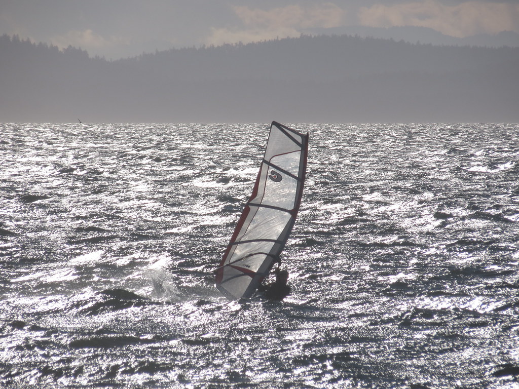
Conditions:
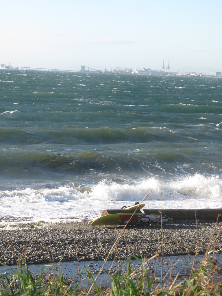
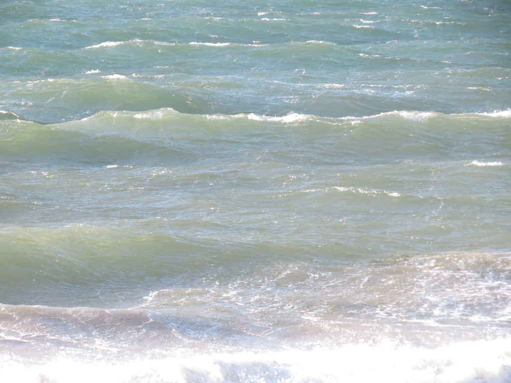
Gulf Road can produce some nice organized rolling swell that sets up in lines near shore. It seems to work best on a mid-tide (~3 m) and can flatten out on a high tide (~4 m).
On winder days, the waves are generated by the rolling swell travelling down the straight. The stronger and longer the wind has been blowing in the north end of the straight, the larger the waves will be, particularly if the tide is working against the waves (or flooding).
- Knee to waist high semi-organized waves growing to shoulder to over-head high on stronger wind days
- Larger rolling swell farther out
- Ramps favoured to starboard on the way out on northwest wind
- Backside rides to port on the way in on northwest wind
Huge expanse of water running about 19 km across to Galiano Island.
Depth/Tide:
It is possible to sail at Gulf Road on any tide height and even low tides don’t pull the water that far away.
- 1 m: To be determined.
- 2m: To be determined.
- 3 m: Water to the shore (nice waves)
- 4+ m: No beach - pounding shore break
Sweet Spot(s):
- On a NW wind the south side of the piles seem to almost act like a jetty of sorts and seem to get the waves to wrap a little on the way in creating a subtle point break, given the right conditions.
- Eelgrass
- Winter: 6/5/3 full suit with hood, boots, gloves
- Spring/fall: 5/3 full suit, hoods, boots
- Summer: 3/3 full suit or less
Right at the west end of Gulf Road.
Rigging Area:
- Grass on the south side of Gulf Road.
- Easier windsurfing launch than Lighthouse Park (less current and less shore break).
- Looking to launch a kite? Best to head to the Ferry Terminal - no space for launching kites here and those huge piles off the beach could be troublesome.
- Breakers Pub
- None.
Cautions:
- Row of piles just off the beach
- Steep shore and shore break on high tide
- US border - do you have out-of-province health care coverage?
- If there is northwest wind in the Straight of Georgia, but it isn’t blowing at Acadia/Spanish Banks in Vancouver, consider heading south to Gulf Road
- You can see the conditions out on the water from bluff in at Fred Gingell Park (at 265 English Bluff Road) in Tsawwassen before you take the time to cross the border
- If the wind lightens you can always exit the water at Lighthouse Park and walk back to your vehicle
When to go:
- Check actual wind direction and speed at Ferry Terminal
General weather forecast for Point Roberts
Marine forecast
NOAA 7-day point forecast for Point Roberts
Ferry Terminal wind sensor
Point Roberts Marina weather sensor
Today's tide
Tomorrow's tide
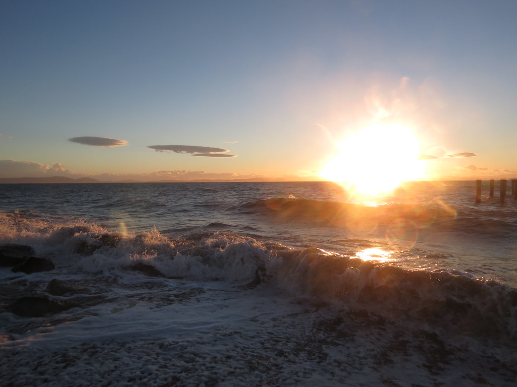
Pictures and Videos
Frontal storms!
Northwest 25-30 mph on a ~3 m tide (2014 Nov 9)
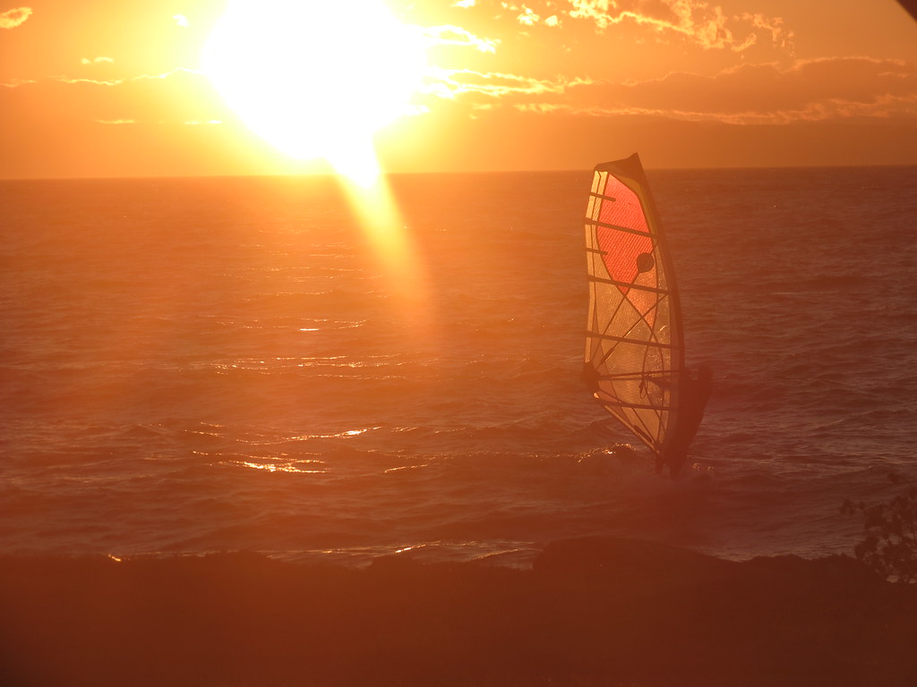
Southeast (side-off) 40+ MPH (2016 Mar 13)
Other Stuff
First Discovered By: M- can you claim this one?
Lore and Legend:
Disclaimer
Every sailor is responsible for sailing safely, including checking local conditions first hand, choosing appropriate gear and sailing within their ability.
Thanks
Thanks to Michael and DB for exploring and sharing what they know.
Updates
If you see anything that should be corrected or you have information that you think should be added, please post it to this thread and we will update the main post. Thanks.
\edit (2015 June 17) - "Eelgrass" added to the "Weeds" section.
/edit: DB's side-off wave video added (2017 Apr 7)

