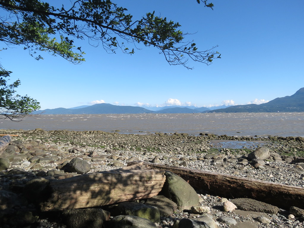
 Beginner
Low tide flat water.

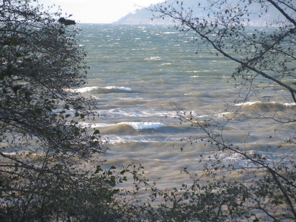
 Expert
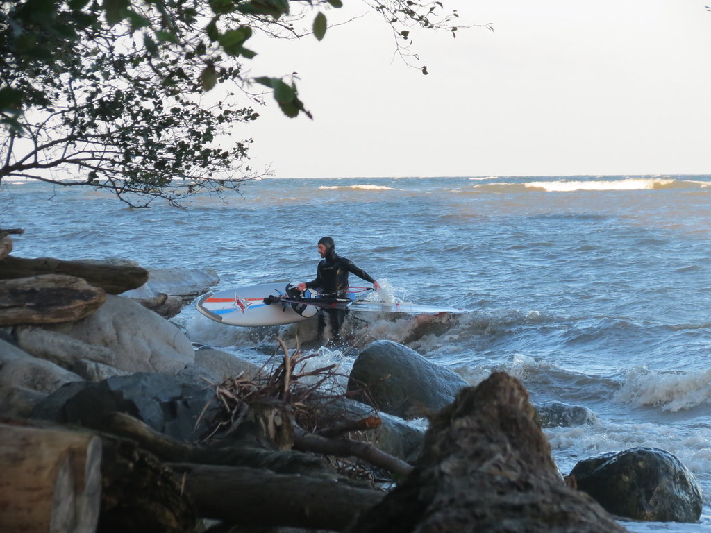
High tide rolling wave storm sailing!

Location
Coordinates:
49.279811,-123.242486
Directions:
- From Highway 99 (Granville Street) in Vancouver
- Turn west onto W 4th Ave
- Turn right onto NW Marine Drive
- Travel the full length of Spanish Banks and start up the hill
- Parking lot will be on the right side beyond the yellow gate

Parking:
- Off street parking in the Metro Vancouver Acadia Beach parking lot
Wind
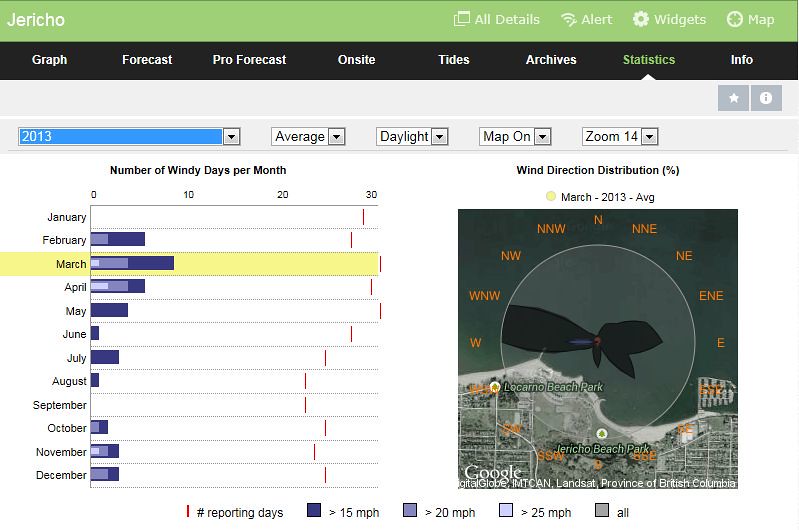
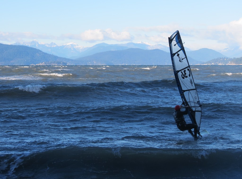
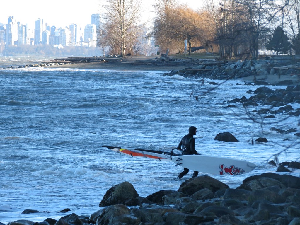
Acadia offers up some pretty nice conditions on big days, but they don’t happen very often, even less so recently it seems.
- Cold weather sailing dominates (although the odd summer session can happen)
- 6 months of the year have 20 mph days (February, March, April, October, November, December)
- 3 months of the year have 25 mph days – March, April, and November
- More days and stronger days in spring (Feb, Mar, Apr) than in the fall (Oct, Nov, Dec)
- Spring (Mar and Apr) can see afternoon thermals approaching 20 mph
- Westerly (clearing) winds dominate
Southwest through northwest.
- Southwest being slightly offshore (as it curves around the tip Point Grey)
- West being sideshore
- Northwest being side-onshore.
- Wind can fan out and become less stable (direction and speed) the further below (east of) the washrooms you sail
- There is a persistent shift or bending of the wind off Point Grey (lift leaving the beach to about the edge of the bank) and a header on the way back in
Water Conditions

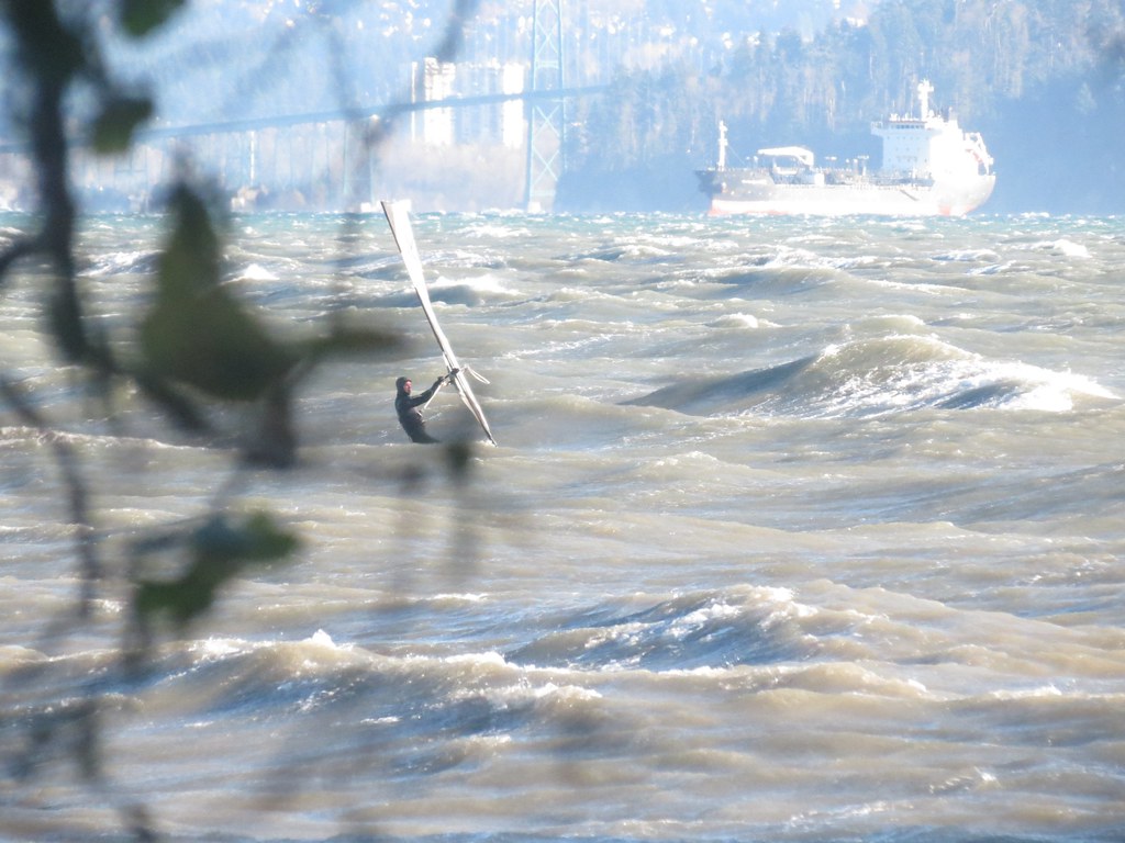
Water conditions at Acadia can range from flat water on shallow tides to large rolling swell with nice jumping ramps presented in both directions (port – photo credit: Tony - outbound and starboard inbound – photo credit: MEnglish). The bank (photo credit: Evan Leeson) extends about 1 km out from Acadia Beach – this is the section that produces the best waves with stronger winds.
- Waves are usually beefy and bell curved in shape (over the bank)
- Ramp shape can often be limited to a pitching face on a large swell or a short section of standing wave
- Riding swell is usually limited to a few linked turns (in onshore conditions)
- Wind/wave angle can be very tight (usually allowing for both port and starboard jumping)
- Wind/wave angle can increase (improve for jumping to port) as waves wrap onto the outer edge of the bank
- outside swell can be large A-frames in the deep channel and can give you the sensation of riding open ocean swell
- The edge of the bank can cause the wave spacing to compress and wrap toward the shore creating a challenging section of water
- Acadia can often feel like a bit of point-fest (always trying to stay even with the beach) part of this may have to do with current from the mouth of the Fraser River
English Bay is about 6 km across from Acadia north to West Vancouver and there is over 6 km of water to east to Kitsilano Beach providing lots of great opportunities for downwinders on big days.
Depth/Tide:
Most people will look for a tide depth of about 2 m or more to sail Acadia, but it is possible to sail ‘Upper Acadia’ (the western end) with less water.
- 0 m – Sail west of ‘Upper Acadia’ (almost at Tower Beach) as the bank is exposed requiring a LONG WALK to reach the deeper water at the edge of the bank directly out from the beach
- 1 m – Sail at ‘Upper Acadia’ (west end of the beach) as water is too shallow directly out from the beach
- 2 m – Knee deep water over the bank – you can sail from either launch
- 3 m – Chest deep water over the bank
- 4 m - Deep water over the bank and large shore break
Click here to read more on wind, tide, and current patterns in English Bay.
Sweet Spot(s):
- The larger waves can often be found at ‘Upper Acadia’ further to the west
- There can be larger flat sections between the waves (photo credit: MEnglish) down near the cove (at the east end of the beach)
- None
- Winter: 6/5/3 full suit with hood, boots, gloves
- Spring/fall: 5/3 full suit, hoods, boots
- Summer: 3/3 full suit or less

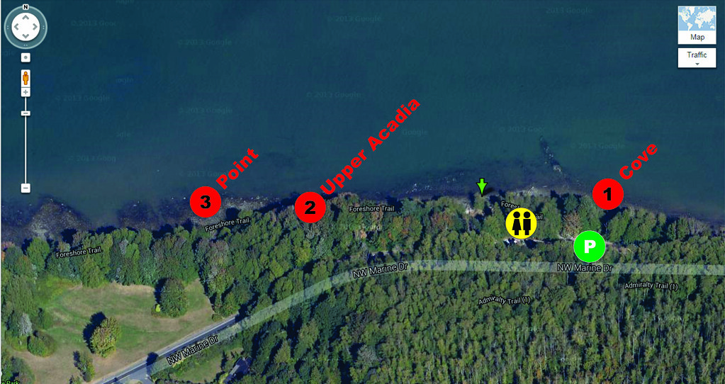
There are three windsurfing launches at Acadia and they all are sideshore launch.
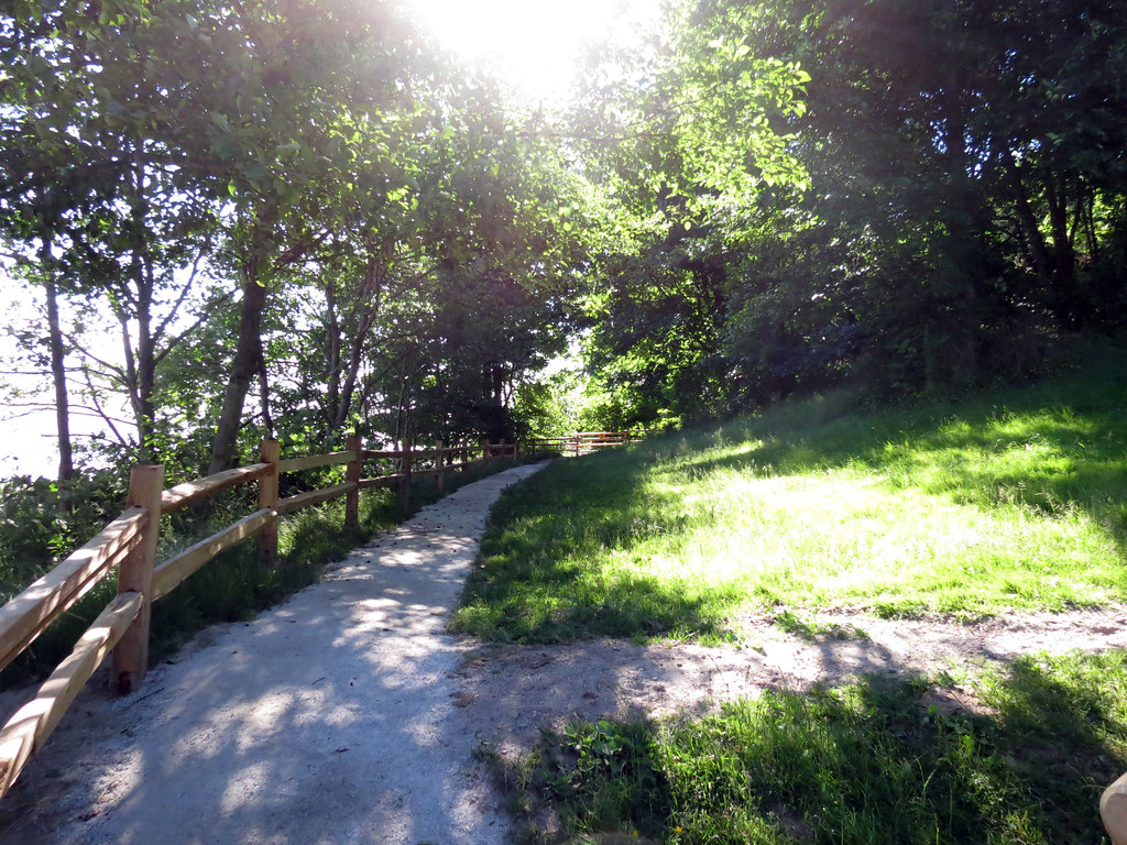
- Cove: Down the hill and turn right and walk along the path to the cove located to the east of the parking lot. There can be a wind shadow (photo credit: Richi) here particularly on a southwest or west wind (a short swim may be needed to get the wind on a high tide). There are also large bounders at both ends of the cove and there can be shore break (use caution on mid to higher tides).
- Upper Acadia: Walk to the west along the path past the outhouse. Once the path narrows, proceed along a few more metres until there is a break in the bushes where you can access the beach. This is a nice place to launch as there is clean wind at the beach (no wind shadow) and you start upwind of the cove. Beware of the large boulders just to the right of the launch (they can be covered with water on higher tides).
- Point: Clean wind and even further upwind and no large boulders along the shoreline. Shore break is usually very manageable. It can be best to use this launch on high tides when the other two have large shore break.

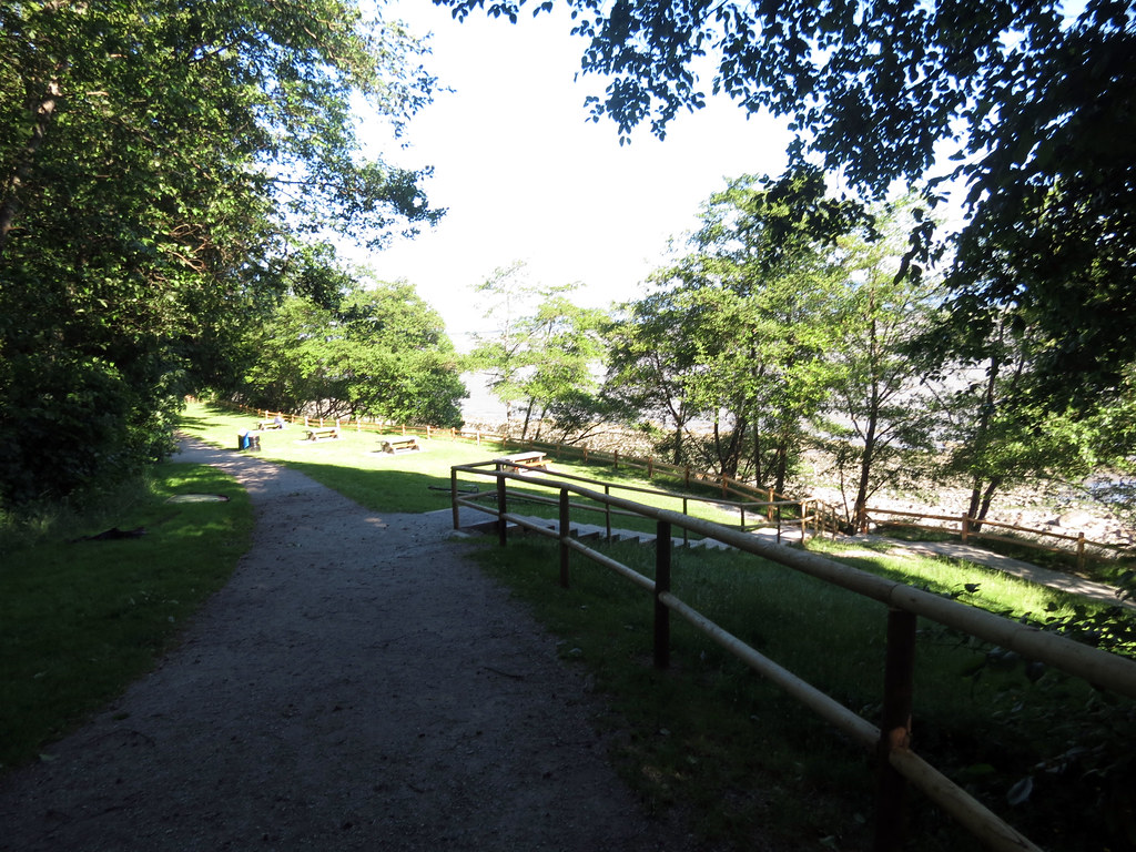
Amenities:
- Washrooms (outhouses) which you can change in
- Picnic tables
- Hiking trails (foreshore and Pacific Spirit Park)
- None.
Cautions:
- Slippery wet grass and clay soil (following a rain)
- Shore break (on mid to higher tides)
- Submerged boulders close to shore (on higher tides)
- Logs pitch-polling along the shore in higher tides
- Logs and debris (from the Fraser River)
- Boat/freighter traffic in the deeper water off the bank
Tips:
- If the shore break is really bad at 'the cove' and 'upper Acadia' walk a little further to the west across the pedestrian bridge to 'the point'
- If the shore break is really bad at all launches at Acadia you can always try the cove in the dog park on the flats of Spanish Banks to the east of Acadia
- If you launch at 'the Point' or ‘Upper Acadia’ and lose some ground you can exit at 'the cove'
- If you are getting blown downwind, try sailing further beyond the edge of the bank to drive upwind in the deeper water before returning back in over the bank – try and work the waves on the edge of the bank to windward on the way back in before you are pushed off the wind on a header once you return back onto the bank
- If the wind is backing off and you are getting blown downwind and waves are still nice, go with the flow and do a downwinder as far as you wish, then walk back to Acadia for your vehicle, then drive back and fetch your gear
When to go:
If the surface pressure analysis shows a daisy-chain of low-high-low pressure systems there a chance of a classic clearing wind (good). Good solid wind to the west/northwest and you see clear skies and a few light grey cotton-ball-like clouds over the north shore. If there is northwest wind in the straight and its not filling into English Bay head for the Tsawwassen Ferry Terminal or Gulf Road in Point Roberts.
Links:
Wind forecast - BWD
Wind forecast – WindGuru – GFS (NW single digits is good)
Wind actual – Jericho sailing centre
Tide
Webcam – Acadia
Webcam – Burrard Bridge
Webcam – Jericho
Pictures and Videos
Unless noted otherwise, all pictures used and referenced in this post are by C36 (all rights reserved).
WNW 40 (gusting 45) mph (2006 Feb 13)
http://thewindsurfer.com/?q=node/2272
Watch for the kite boosting air at the top of the frame at 5:20.
Other Stuff
First Discovered By:
Lore and Legend:
Disclaimer
Every sailor is responsible for sailing safely, including checking local conditions first hand, choosing appropriate gear and sailing within their ability. Have fun, sail safe!
Thanks
Thanks to Metro Vancouver for operating this park. Thanks to Elliot E, and PeterG for sharing their local knowledge.
Updates
If you see anything that should be corrected or you have information that you think should be added, please post it to this thread and we will update the main post. Thanks.
/edit (2015 Mar 8): Winter storm sailing upgraded to "Expert" and picnic tables/hiking trails added to "Amenities" section
/edit (2015 Mar 9): "Water Conditions" section - link added to Evan Leeson's aerial shot of bank at low tide
/edit (2015 Sept 22): joeschmoe's Sept 20, 2015 kiteboarding video added
