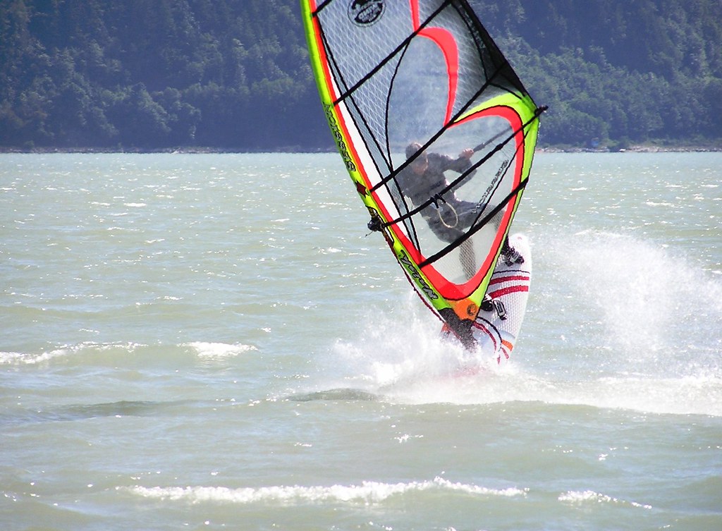
 Intermediate
Flat water summer thermals.


Location
Coordinates:
49.686713,-123.178276
Directions:
Click here for directions.

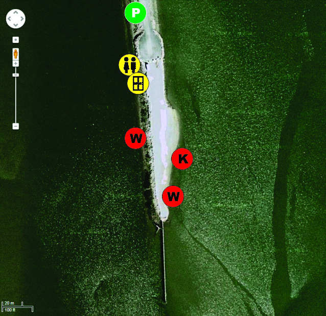
Parking:
- Drive right to the south end of the spit to drop-off your gear.
- Gear drop-off only (no parking) in the turnaround (at the south end of the spit).
- Return back up the spit to angle park.
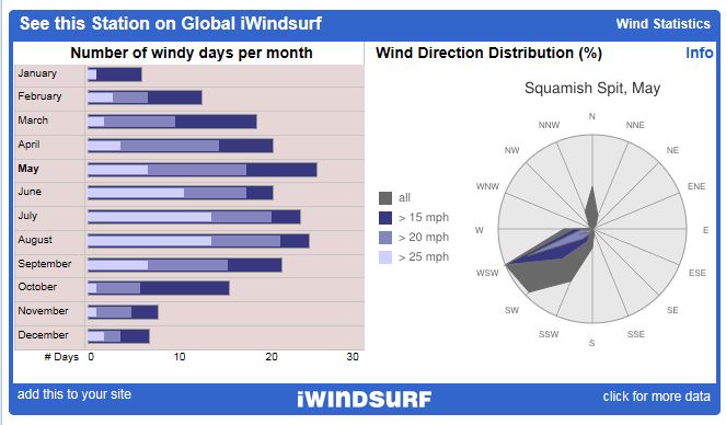
Seasons/Days/Strength:
- 12 months have 25 mph days
- 6 warm weather months (Apr, May, Jun, Jul, Aug, Sep) have more wind, more often – all with more than 20 kiteable days
- July and August both have about 15 days over 25 mph
- West-southwest wind dominates
- North (outflow) days seem to be under reported on the wind rose
- South-southwest through southwest and north (although not many sail them).
- Squamish can be an acquired taste. You may need a few sessions to become familiar with all it has to offer (launches, current, sandbars, voodoo chop, power zone/dutch oven at cliffs), but it can offer up fun flat water sailing.
- Afternoon thermals – you can work the morning in the city or sleep in and still get a session in!
- Clear blue skies and warm sunshine make for good days
- The wind is often the stronger in the mouth of the river and strongest just off the wall
- The wind then gets lighter to the further to windward (south) you sail
- If the wind has a west pressure system component to it, it can puff off the wall and be really unstable
- If Vancouver gets over 25 degree Celsius it can temper the thermal
- In general clouds/rain are bad (they can cause weak, unsettled conditions) - although southerly pressure push can produce solid 25 mph days that start early and last long
- The day after a rain can have a thermal (unlike Nitinaht Lake where the Cowichan Valley needs a few days to dry out after a rain)
- Early spring (Mar, Apr) and late fall sailing (Sep) can be lighter and touch spooky (unstable and shifty)
River:
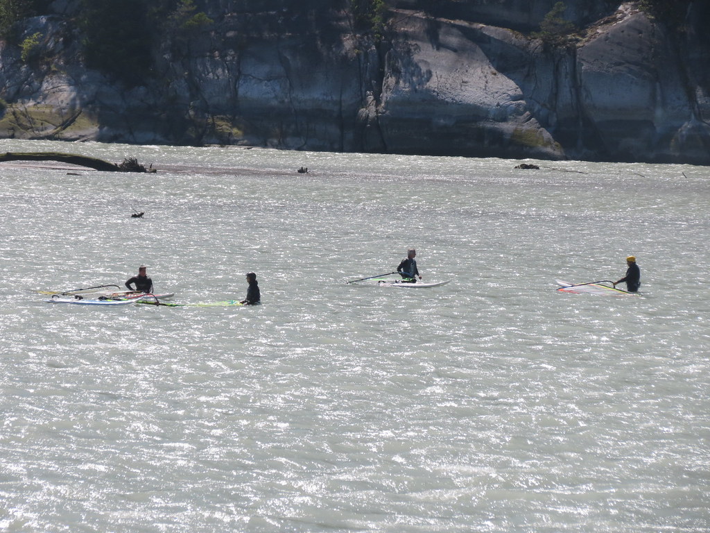
Sailing the river side is the preferred choice for windsurfing freestyle (especially on super flat water low tides), smaller gear and/or marginal conditions.
- Uber flat water on low tides
- Small semi-organized rolling choppy swell that favours jumping to starboard and mini-backside rides to port on small rolling swell on higher mid-tides
- On high tide the river acts more like the sound (less current and more typical open water chop)
- 'Potato patch' of voodoo chop where the mouth of the river meets the deep water of the sound
The estuary is the preferred launch when it has filled in (easy to sail upwind) or you can walk out to the end of the pier to access the river on a low tide.
- The inner portion of the estuary is often called the ‘honey hole’ as the twin tip kiteboarders swarm to the flat water in the lee of Spit.
- On lower tides the exposed bank provides a barrier to the chop and increases the area of flat water further to the south and east of the Spit out into the estuary

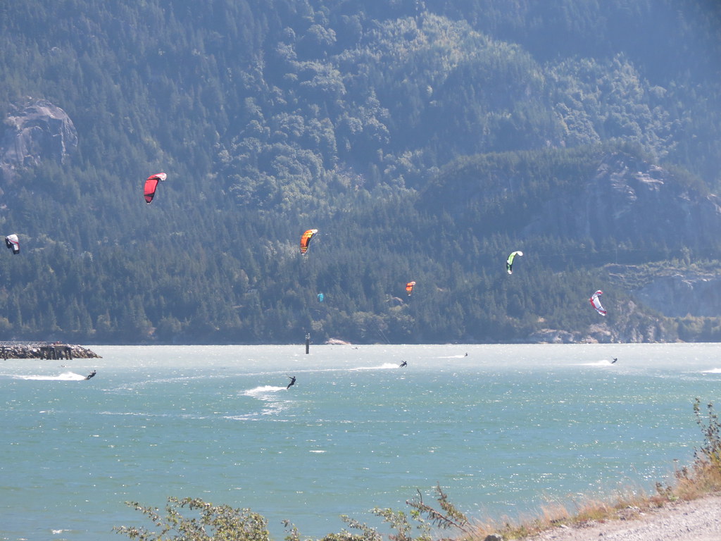
Once out on the water there is a third area to sail – the open sound.
- Open water chop typical of a large lake
- If the wind is strong and tide is flooding (coming in) the swell can often begin to roll down at Nexen (a short sail downwind to the northeast)
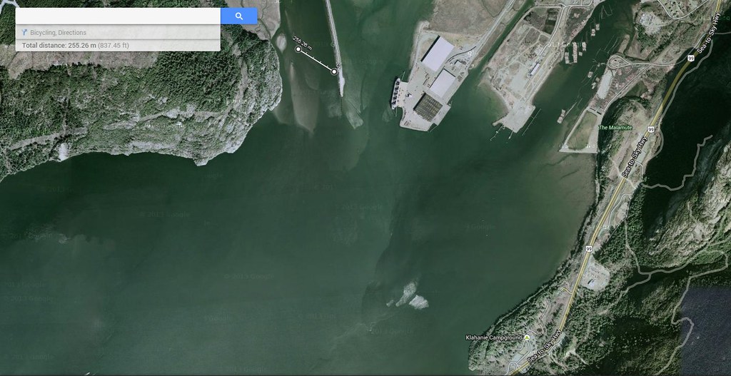
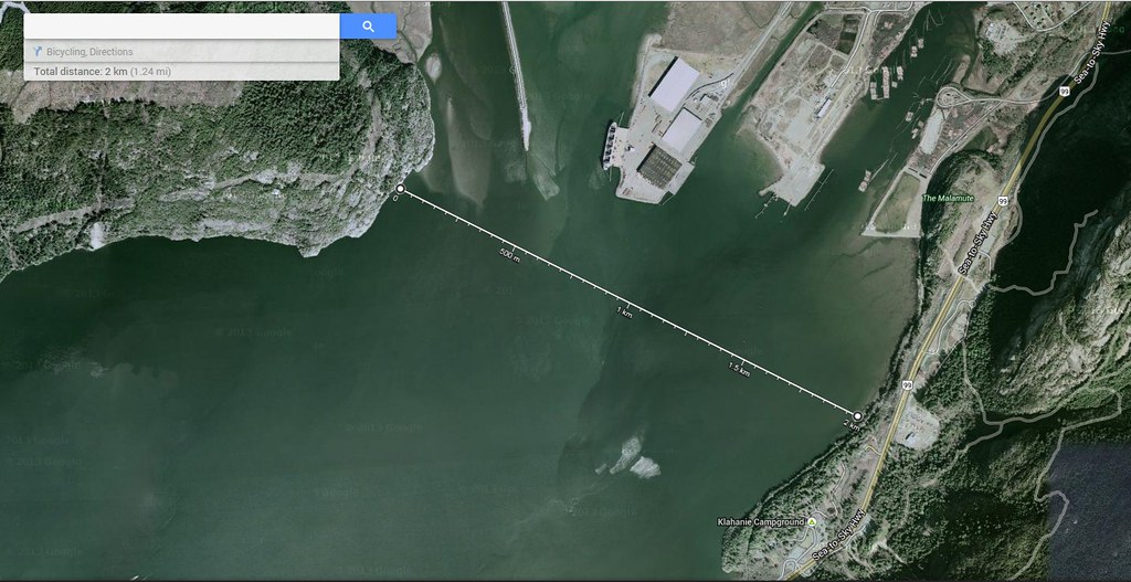
The river is about 250 m wide and Howe Sound is about 2 km wide at the end of the Spit.
Depth/Tide:
It is possible to sail at the Spit on any tide height, although a short walk (on a low tide) or short swim (on a high tide) might be required.
- 1 m - Bank and sandbar are both fully exposed – SHORT WALK to the river
- 2 m - Shallow water over the sandbar, bank and in river mouth - SHORT WALK
- 3 m - Deep water in the river mouth and chest deep water over the sandbar – NO WALKING
- 3.5+ m - Shore grass is flooded – deep water everywhere (formula gear and foil boards can sail where they choose)
Sweet Spot(s):
- Flat water in the river (on low tides)
- Small rolling swell along the inside of the piles (use extreme caution here) and Spit
- Organised water up by the cliffs (to windward of the sandbar)
- Short steep ramps to the east of the bank
- Rolling swell and jumping ramps near the two ‘cans’ off the harbour entrance (stronger wind and incoming tide help to create these)
- None
- Winter: 6/5/3 full suit with hood, boots, gloves
- Spring/fall: 5/3 full suit, hoods, boots
- Summer: 4/3 full suit or less
- Mats for rigging on.
- Pea-gravel and rock on the estuary (Sound) side.
- Rock on the river side of the Spit.
- Sand on floor of the river, sandbar and bank (on the estuary side).
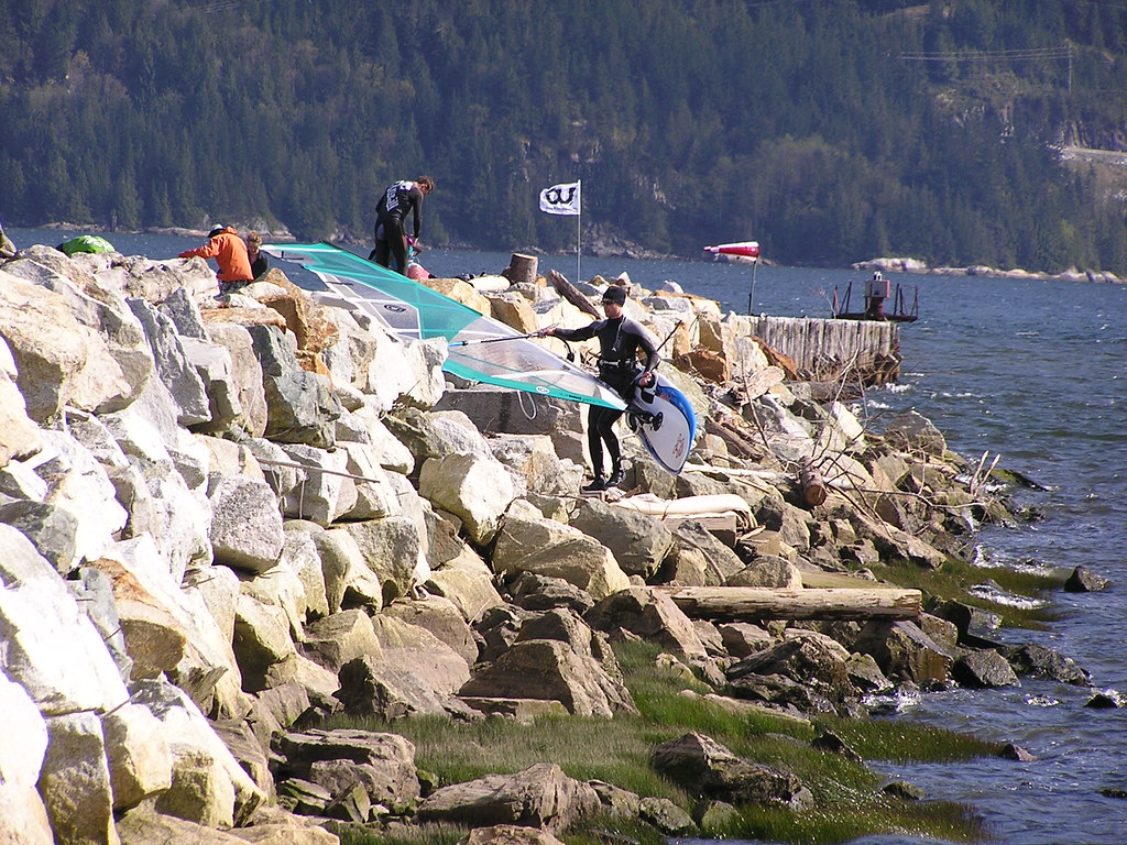
- Rigging mats at the south end of the spit.
The rigging area can be crowded and the launch can be tricky at the Spit.
- Rig and launch at the end south end of the spit.
- Windsurfers rig at the north end of the mats (closest to the shed)
- Kites pump up at the south end of the mats (when kites are not in use, please deflate them)
- Kites launch into the Estuary (Sound side)
- Windsurfers can launch into the river from the stairs or into the Estuary (Sound side)
Estuary (Sound) side

Launching in the estuary is easier as there are no stairs or river current, but there can be a wind shadow caused by the wooden plies at the end of the Spit (especially when the tide is so high you have to swim off the beach).
- Kites use this side
- Windsurfers should stick to the estuary (sound) side your first time out. Don't launch into the river until you are sure you can do it.
- There is a bank on this side of the Spit that offers shallow water on tides of less than 6’
River (windsurfers only)
The river side launch offers clean wind and direct access to the river.
- The river launch is tricky - cold glacier-feed water, rocky shore, fast current, debris, etc.
- Think of the worst tide you have ever sailed in and then double that - that's what the river can be like.
- At low tide the river mouth narrows so the flow is faster.
- At high tide the river mouth is wider and flow backs off a little, but the first step into the river is deep!
- There is a ‘conveyor belt’ effect when sailing upstream into the river - you get a boost of a couple of knots of apparent wind, but the reverse is true once you jibe (less power in the sail and harder to point).
- If you want to sample what the river is like, sail into the mouth when the tide is about 2 m and you can stand on the sand bar - stay upwind (away from the spit).
If you choose to launch in the river:
- Point the nose of your board into the strong river current with mast parallel to current.
- Never, ever, ever let your clew drop into (against) the current when your board is pointing way from the steps (the river current and rocks have been know to shread rigs) - only downstream when returning to shore.
Amenities:
- SWS operates the site including change rooms, porta potty, webcam, weather station, rigging mats, compressed air for kites and rescue service.
- Squamish offers a range of restaurants and services
- Camping is offered at Alice Lake Provincial Park and the Stawamus Chief Provincial Park
- Launching fees (per person) by the Squamish Windsports Society (SWS) – daily rates and season passes are both offered.
Click here to view current rates.
Cautions:
- Current in the river (when launching and sailing)
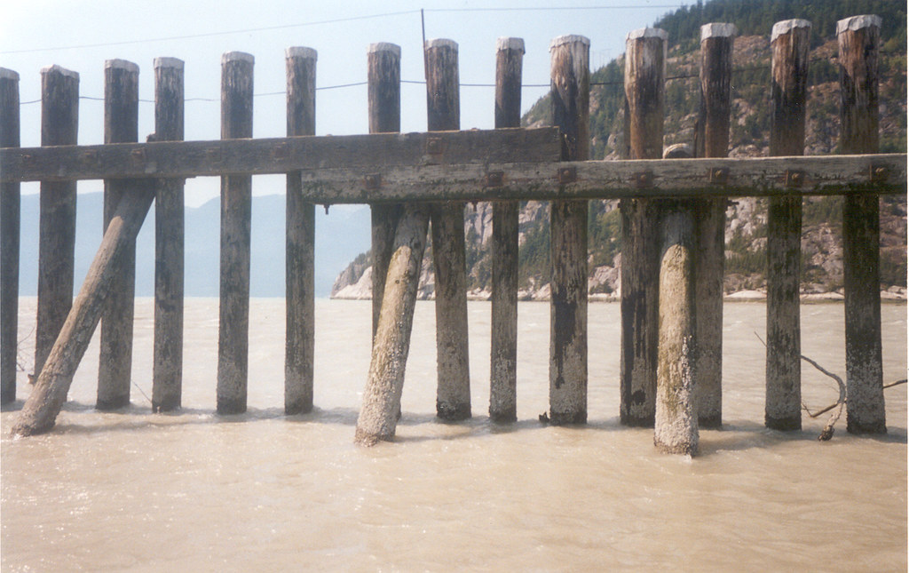
- The “cheese grater” (the piles at the end of the spit) – the current from the river pulls toward them and can press gear up against them
- Submerged logs (in the river, on the sand bar and on the bank in the estuary)
- Debris in the river
- Sandbar at the mouth of the river (can change seasonally)
- Seals fishing
- Kites knifing out of the sky (several schools operate here)
- Kite school boats taking students upwind and downwind
- Kite race board sailing (beating) upwind or diving deap (broad reaching) off the wind
- Boat/freighter traffic
Tips:
- First time out, ask the Squamish Windsports Society (SWS) staff for an orientation - ask lots of questions before taking to the water
- The wind can feel stronger at the rigging area - go down to the river's edge to get a true sense of wind speed before rigging – or use the steel wedge on the spit (its more accurate than the sensor at times)
- First time out, launch into the estuary (leave the river for later)
- If there is a lot of west in the wind at the Spit, check out Nexen
- If you are launching in the river (windsurfing only), keep the clew of your sail above the water
- If you feel really hot puffs of air, stick close to the spit (the wind may be getting ready to shut down)
- Also check out the Squamish Windsport Society’s FAQ page
- Click here to watch a short video on how to carry your windsurfing gear "Hawaiian style" (thanks to "Leopard Skin" for posting).
When to go:
Predicting wind at Squamish is as much an art as it is a science as there are several contributing factors including pressure (infow or outflow), thermal (temperature gradient from Vancouver to Lillooet), and cloud cover.
Sunny Days – look for:
- Clear blue sky over Squamish and the Pemberton Valley
- Inflow wind being predicted for the Howe Sound
- Temperatures rising from Vancouver inland to Lillooet
SATELLITE

LILLOOET
PEMBERTON

WHISTLER
SQUAMISH

Cloudy days can crank, but it takes a special set-up with several pre-conditions (Igor’s ‘nuking rule’):
- A string of hot weather days. Squamish will be weak or even starts outflowing during this time.
- Then, sudden cooling forecast for the coast.
- Windguru GFS forecast will predict 7+ knots of consistent southerly flow.
- A morning marine layer of clouds may form over Vancouver is good.
- Squamish will start to inflow early around 8-9 am. Centennial may also show light SW flow.
Squamish Windsports Society
Wind Forecast - Alton’s Temperature Grid
Wind Forecast - WindGURU, Squamish
Wind Forecast – Howe Sound
Satellite - NRL
Tides
Frieghter Schedule
Webcams - SWS page
Webcams - Squamish Airport
SWS Wind Sensor
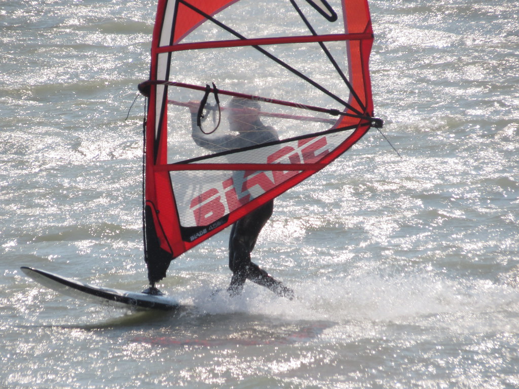
Pictures and Videos
Unless noted otherwise, all pictures used and referenced in this post are by C36 (all rights reserved).
Other Stuff
First Discovered By:
Lore and Legend:
- When the tide changes direction, it can temporarily dampen the wind
- Mid-afternoon dip in the wind speed is caused by the sunshine leaving one valley and then warming another
Every sailor is responsible for sailing safely, including checking local conditions first hand, choosing appropriate gear and sailing within their ability. Have fun, sail safe!
Thanks
Thanks to Alton, Elliot, Igor, PeterG, and Tony for sharing their local knowledge. Thanks to the Squamish Windsports Society members, executive, and staff for operating this great site.
Updates
If you see anything that should be corrected or you have information that you think should be added, please post it to this thread and we will update the main post. Thanks.
/edit (2015 Feb 28): Link to WindGURU, Squamish added to "Links" section.
/edit (2015 Jun 4): Alton's webcam links added to "When to go?" section.
/edit (2017 June 6): NOAA satelite image and link replaced with NRL satellite image and link and link to SWS webcam updated.
/edit (2018 Jun 9): Navy satellite image changed to NOAA 4 km and SWS webcam link updated.
/edit (2020 Jun 6): UofW satellite image added and two deadlinks to webcam images (including SWS beach cam - new string is too long) removed.


