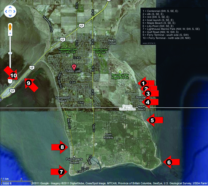
Including Centennial Beach, 4th Avenue, 3rd Avenue, the boat launch (1a Avenue) and Maple Beach
 Intermediate
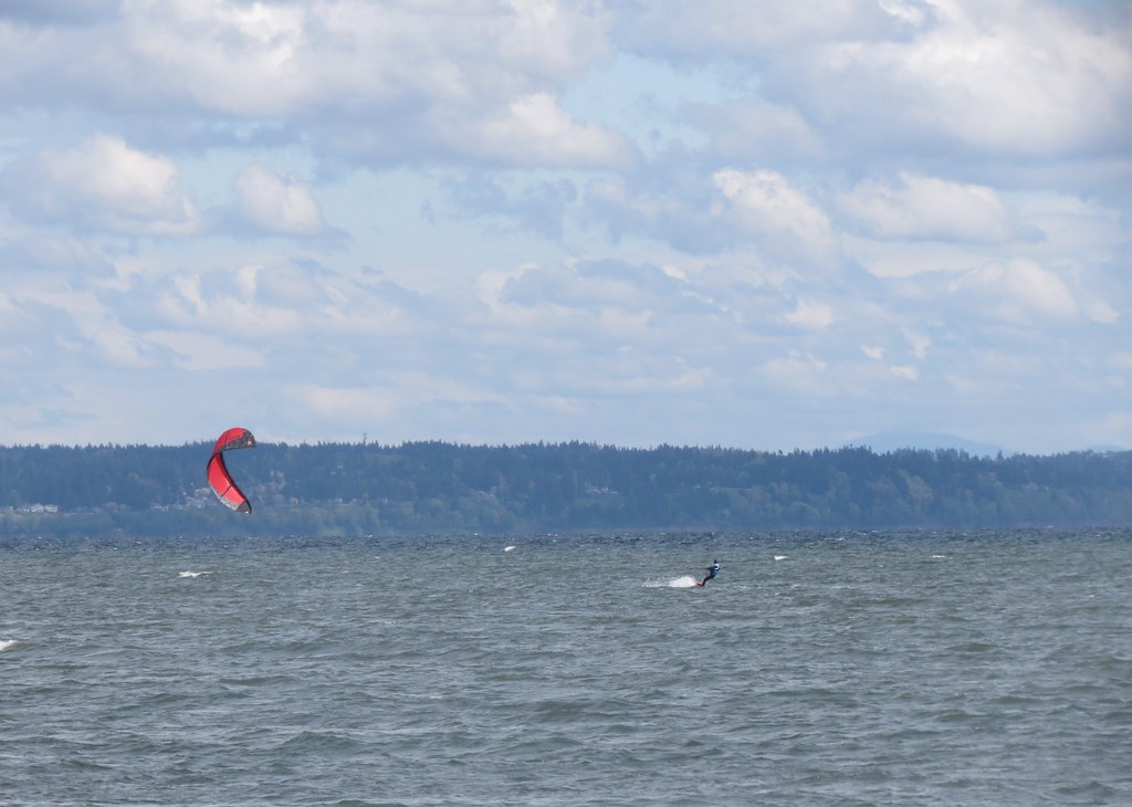
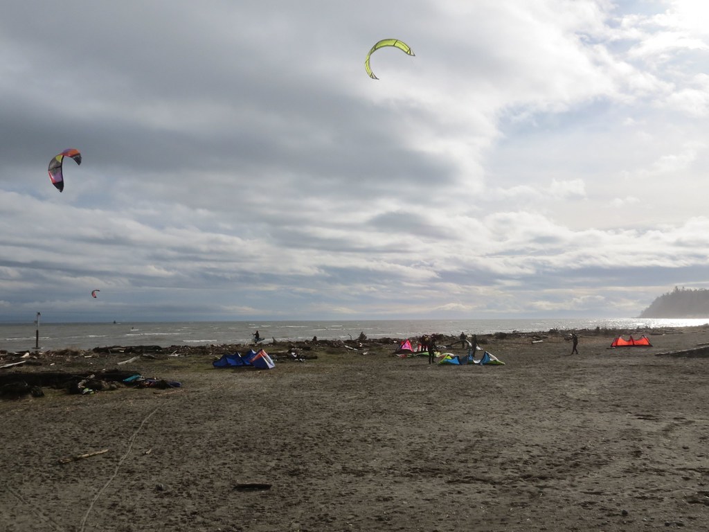
Gentle summer flat water.
 Expert Sailing
Storm front waves!


Location
https://maps.google.com/maps?q=Locust+B ... 8&t=h&z=18
Coordinates:
1. Centennial: 49.014708,-123.040941
2. 4th Avenue: 49.010036,-123.036661
3. 3rd Avenue: 49.008502,-123.036103
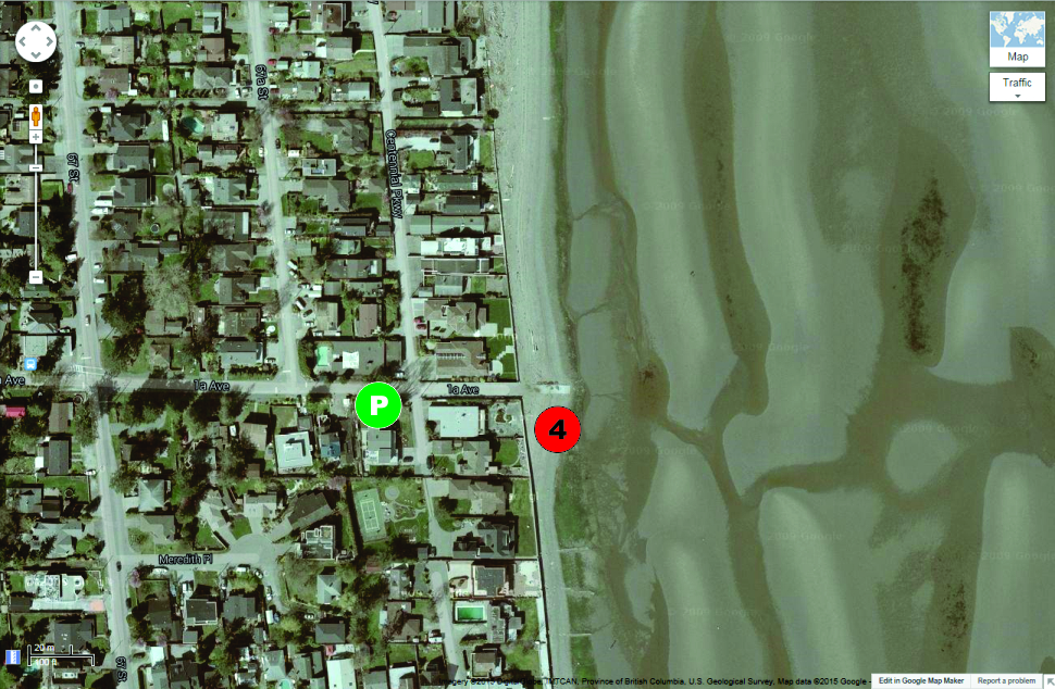
4. Boat launch (1a Avenue): 49.004701,-123.035481
5. Maple Beach: 48.994889,-123.03179
Directions:
- Find your way to the South Fraser Perimeter Road (Highway 17)
- Travel west toward Tsawwassen/Point Roberts
- Turn left onto 56th Street into Tsawwassen
- Turn left onto 12 Avenue
- Stay right and continue onto Boundary Bay Road
- Turn left into the entrance of Boundary Bay Park*
- Turn right at the stop sign to reach the south parking lot (windsurfing only)
Parking:
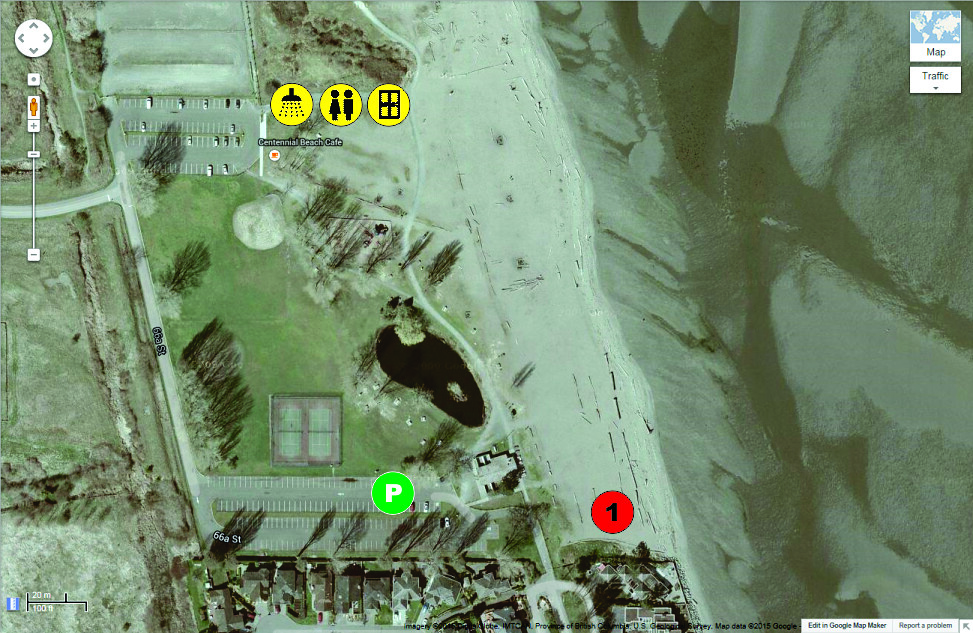
1. Centennial:
- Is gate controlled and hours change seasonally - if you arrive early and the gate is locked park and launch at 3rd
- Use the south parking lot (nice grass rigging area and closest to the launch)
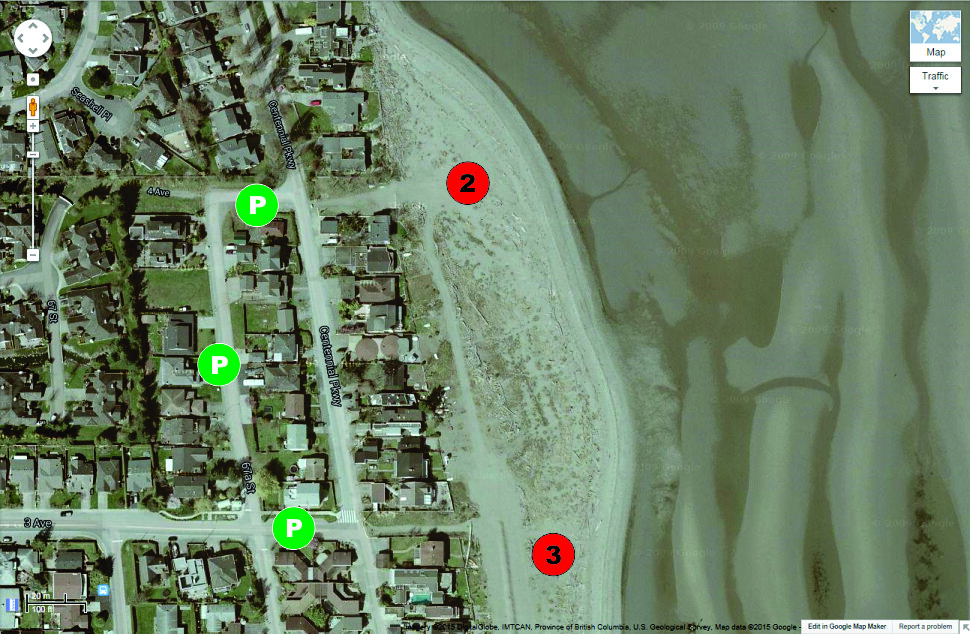
2. 4th Avenue:
- On street parking on the residential streets (please be courteous to the residents)
- On street parking on the residential streets (please be courteous to the residents)
4. Boat launch (1a Avenue):
- Four off-street angle parking stalls (one handicapped)
- On street parking on the residential streets (please be courteous to the residents)
5. Maple Beach:
- On street parking is available on Roosevelt and some of the other residential streets
Wind
Seasons/Days/Strength:
Centennial offers up more days of storm sailing than any other spot in Metro Vancouver, but isn’t as frequent as spots on the Island (Columbia and Comox) or spots to the south (Locust and Whidbey Island).
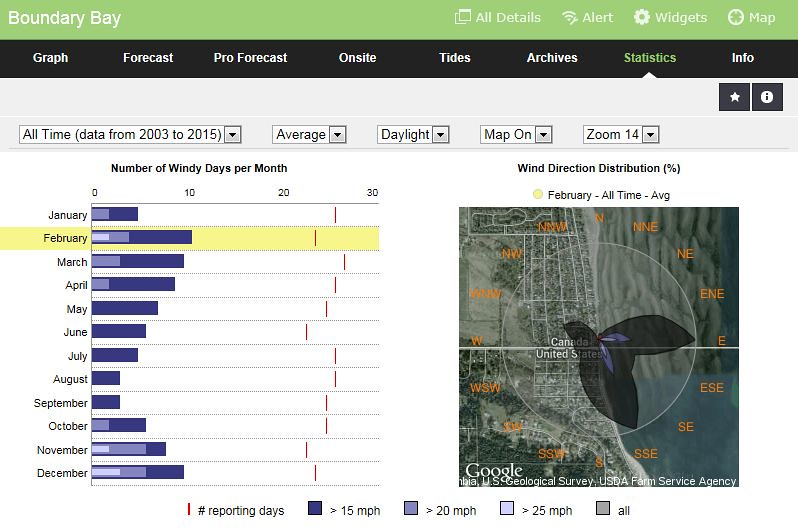
- Cold weather sailing dominates
- 7 months of the year have 20 mph days
- Only 3 months of the year have 25 mph days - February, November and December (surprisingly March doesn't show better)
- More days in spring (Jan, Feb, Mar, Apr) but stronger days in the fall (Oct, Nov, Dec)
- Summer is kite weather
- Look at all the east wind (about half)
Northeast through southwest
- Northeast (cold, steady artic outflow, often flatter water)
- East (straight onshore, small waves at 3rd and Maple Beach on higher tide)
- Southeast (steadier wind and swell)
- South-southeast (steadier wind and larger swell – more fetch)
- South (puffier sideshore wind and down-the-line opportunities in the shore break at 3rd/4th)
- Southwest (gusty, side-offshore wind that can allow down-the-line rides further offshore).
East wind:
- Wind can be strongest to the south of Centennial and gradual get weaker to the south toward Maple Beach (rising land maybe lifting wind off the water)
- Wind can shut off quickly
- 3rd – wind can be slightly stronger and more consistent then at Centennial
- Centennial – the wind can fan out (and get weaker) to the south of the launch
Conditions:
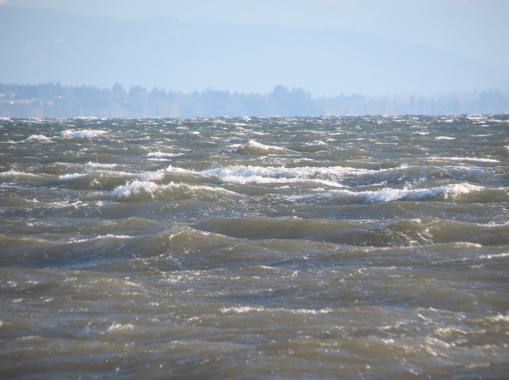
Centennial often creates more of a crumbling wind-blown wind swell than a wave, although clean standing lines of waves can be presented and these are more common on the second bank (outer) bank of Boundary Bay.
South 20-25 mph (2015 Feb 5), photo credit: Michael
On winder days the waves at Boundary Bay are generated by the rolling swell from the deeper water breaking over the shallow flat benches of sand.
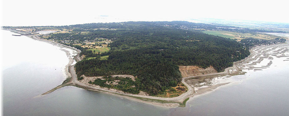
Photo credit: http://lilypointparklodge.com
The picture above shows the first bank exposed in a low-mid tide looking north from Lilly Point in bottom centre, Maple Beach on the centre right and 3rd/4th/Centennial in the upper right. As shown in the photo the edge of the first bank is much closer at Maple Beach than it is at Centennial. The graphic below shows the estimated edge of both the first and second banks as they sweeping away from the beach from south to north. The estimated distances of the two banks are listed below, moving from north to south you can see the distances decrease:
- Centennial Beach: first bench about 1.5 km and second bench about 3.0 km
- 3rd/4th Avenue: first bench about 1.2 km and second bench about 2.4 km
- Boat launch: : first bench about 1.1 km and second bench about 2.2 km
- Maple Beach: first bench about 0.6 km and second bench about 1.9 km
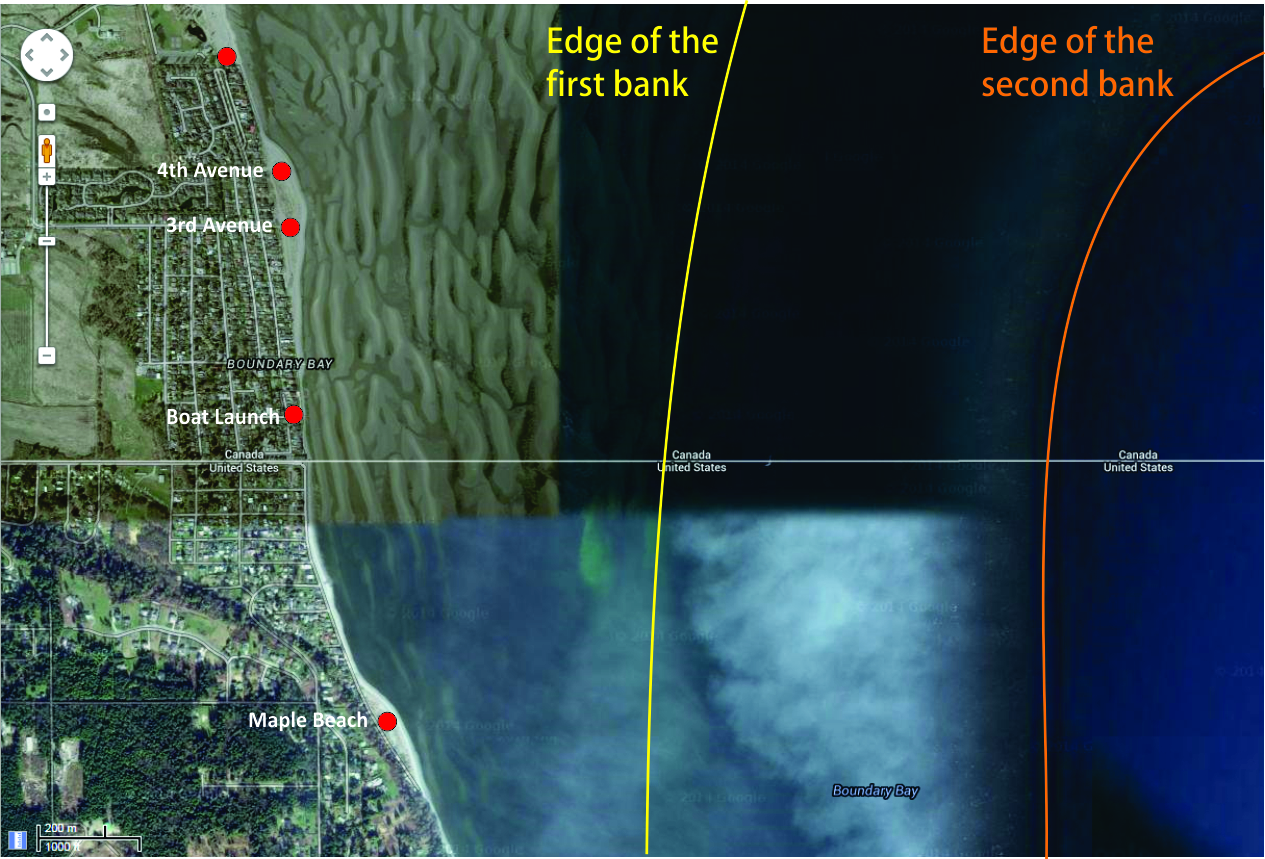
Understanding the shape of the benches of sand in Boundary Bay helps to understand the water conditions.
Regardless of which launch you choose, the water conditions (wind swell/waves/ramps) often get better (bigger wind swell/waves/ramps) the further you go out until you hit the edge of the second bank and here they turn into deep water rolling swell. That’s why it is so hard to get a picture of what it feels like out in the ‘good stuff’, because it is so far out!
The best water conditions (wind swell/waves/ramps) seem to show up when the tide is about 3 m or higher and there is more water pushing over both banks.
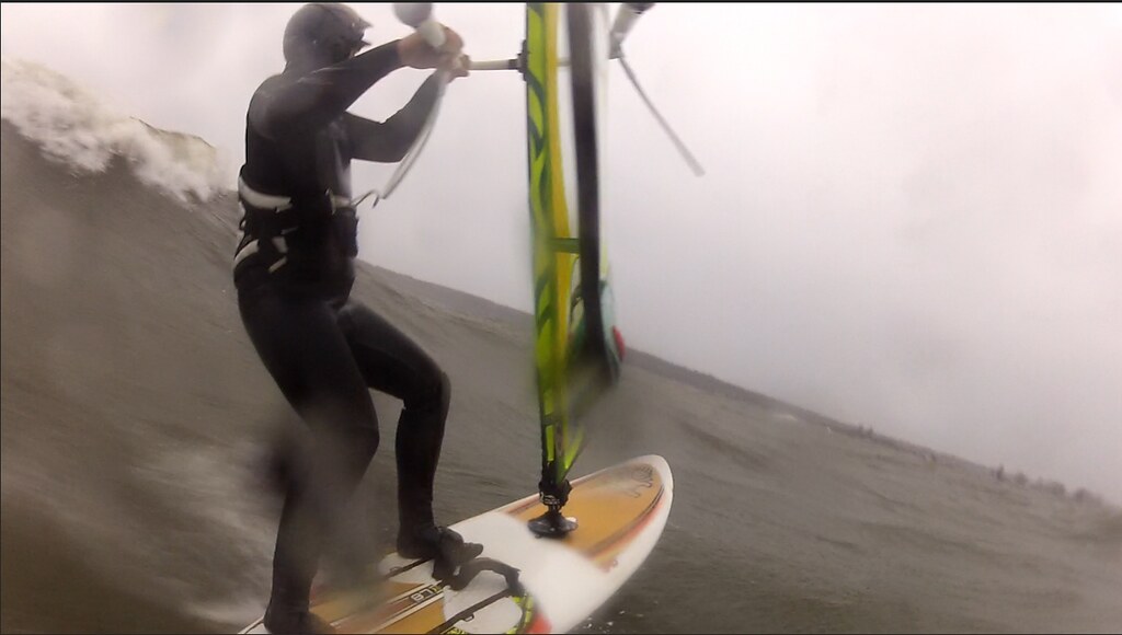
South 30-35 mph (2014 Dec 9), photo credit: Michael
On a good solid southeast through southwest wind:
- The water conditions can vary greatly from launch to launch on any given tide, but in general the nicest wind swell/waves/ramps can be found between 3rd Street and the boat launch. Even on the same day the difference between Maple Beach, the boat launch, 3rd Avenue, 4th Avenue and Centennial Beach can be dramatic.
- Inside (over the first bank) waves are generally good jumping ramps (short and steep) that sweep toward you in the side-onshore wind, but they are not really fast enough or organized enough to ride – they crumble (pitch, peak, sluff, and reform but do not really break, close-out or dump).
- Inside (over the second bank) the wind swell is more wave-like (there are often tightly spaced standing waves in lines over sections of the second bank, depending on tide depth, tide direction, and wind/wave angle).
- Ramp shape over the first bank on a shallower tide can often be quarter-round “C” shaped and taller, more vertical (or wall like) on the second bank.
- Jumping opportunities abound (with larger flat sections between waves at Centennial allowing you the opportunity to build speed) with waist to shoulder high ramps common on ‘good’ days. If you enjoy jumping starboard, this is the spot for you!
- Ramp/wave spacing is often greater off Centennial (there are often larger flat sections between ‘ramps’) and grows tighter the further south you go and they can be very tightly spaces at 3rd Avenue in certain conditions.
- The ramps at Boundary Bay are large enough and steep enough for windsurfing back loop at 3rd Avenue – Daniel (DD) was seen to land two in one session (one he didn’t sail away from, but they were both pretty impressive). Even when 3rd Avenue sets up ‘just right’ you may have to watch for a ride out over both banks to get one wave face to stand up and say ‘back loop please’.
- Outside swell can be moderate to large rolling swell – similar, but rounder than the deep channel at Acadia with jumping to starboard and port (if you drive to windward).
- Riding waves is usually limited to a few linked backside turns or a single backside-frontside-backside transition (either outbound or inbound), but backside rides inbound to windward are possible if the wind/wave angle sets up right (most common just off 4th Avenue in the lee of the 3rd Avenue point)
- Although the side-offshore wind on a southwest wind can produce a wind/wave angle that can present some short down-the-line riding opportunities
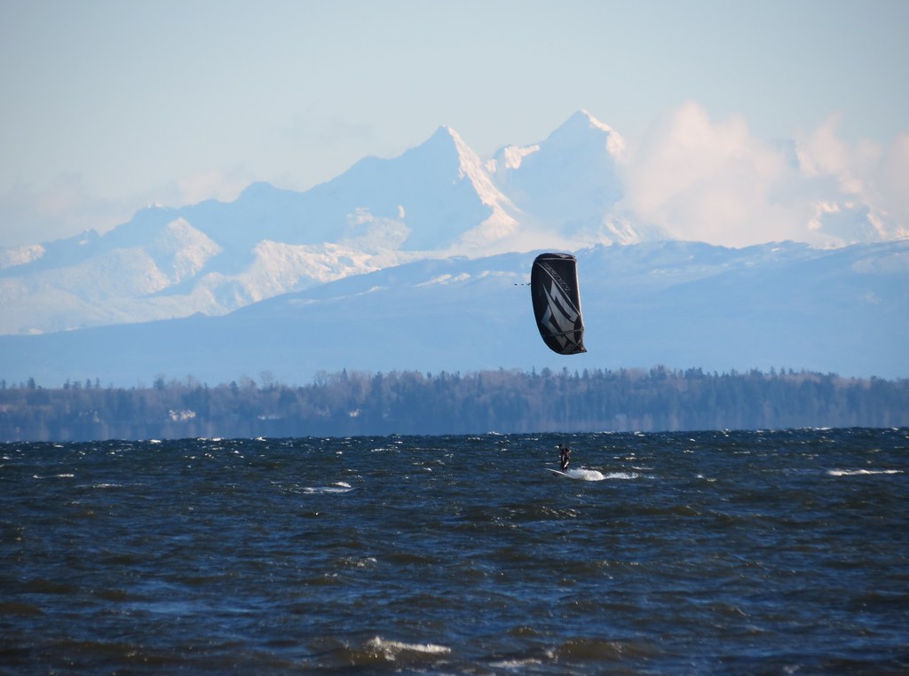
On a east wind the bay tends to stay flatter, but with stronger wind on a higher tide some decent chop and small waves can begin to roll.
Width:
The bay is about 11 km wide between Centennial and Crescent Beach in White Rock and Maple Beach is over 2 km south of the launch at Centennial, so there is lots of open water. For those that want to cruise around a sail south (upwind) to Lilly Point (4 km south of Centennial) can prove to be fun adventure in steady wind and with a complimentary wind/wave angle.
Depth/Tide:
It is possible to sail Boundary Bay on any tide height – it’s just a matter of how far you will have to walk to reach the water. But at Centennial it can be a LONG walk on lower tides!
4+ m:
- Launch at the beach (all beaches)
- NO WALKING at any of the beaches
- Water over head high on the first back – you will be swimming after you launch
- Launch at the beach (all beaches)
- NO WALKING at any of the beaches
- At Centennial about 100’ of the first beach can be exposed or be too shallow to sail over
- water is about chest deep over the first bench
Centennial
3rd Avenue
Boat ramp
- Some of the sand from the first bench will be exposed
- MEDIUM WALK at Centennial
- SHORT WALK at 3rd
- The outer half of the first bench may have some knee deep water
Centennial
- LONG WALK @ Centennial (over a km as the first bank would likely be fully exposed and the second bank may only be partially sailable)
- MEDIUM WALK at 3rd
- SHORT WALK at boat launch (with some sailing fairly close to shore)
- Second bench is sailable at all beaches
Centennial
3rd Avenue
Boat ramp
- Second bench is exposed
- VERY LONG WALK (~3 km at Centennial or ~2 km at the boat ramp)
- LONG WALK at 3rd
- MEDIUM WALK at boat launch
- Its doable, but only if you REALLY want a session
- I couldn’t find any example pictures – the water must have been too far away!
Alton once mentioned that these tide heights are “predicted”. This is an important point as I have noticed that tides that are “predicted” as higher can seem lower and tides that are “predicted” as lower can seem higher (almost a meter different). This sometimes means you are walking out or home when there was ~3 m “predicted”.
Sweet Spot(s):
East wind:
- Playful little knee-high waves off the boat launch
- Waist-high waves off Maple Beach
- A field of waves can appear to either side of the boarder marker (concrete monolith) on a predicted tide of about 1.6 m
- Outer edge of the second bank off Centennial (waves can set up in clean lines)
- The sand bar in the cove off 4th on a higher tide
- Shore break at 3rd on a higher tide (particularly on a south or southwest wind)
- Big swell south of the boarder marker (concrete monolith)
- Over the second bench and beyond (depending on the tide)
- Heavy (fall) to light (spring) – Eelgrass
- Winter: 6/5/3 full suit with hood, boots, gloves
- Spring/fall: 5/3 full suit, hoods, boots
- Summer: 3/3 full suit or less
Centennial is the largest of these beaches, followed by Maple Beach, 3rd, 4th (which really is the northern end of the point at 3rd) and the boat ramp (which is quite narrow). On a mid to low tide all of the beaches are connected by the sand of the exposed first bench.
Rigging Areas:
- Centennial: grass lawn (windsurfing gear only)
- 4th Avenue: grass lawn on the boulevards on 4th Avenue (windsurfing gear) and the open sand of the upper beach (kites)
- 3rd Avenue: grass lawn on the boulevards on 3rd Avenue (windsurfing gear) and the open sand of the upper beach (kites)
- Boat launch (1a Avenue): hard surface and wild grass (windsurfing gear)
Maple Beach: to be confirmed
- Launch into side-onshore conditions in a SE (side shore in a south and onshore on an east wind)
- Windsurfing only at Centennial Beach (Metro Vancouver doesn’t allow kites)
- Lots of room to stage and launch kites at 3rd
- Narrow beach at boat ramp on high tide, sand bench exposes on mid-1 m tide
- Change rooms/washrooms at Centennial (all year)
- Outdoor showers at Centennial (summer only)
- Café at Centennial (summer only)
- None
Cautions:
- Shore break on high tide/storm surge
- Floating logs on high tide/storm surge
- Nasty reflective wave off shore to the south of the boat launch (caused by the vertical concrete break wall) on a high tide
- Sand bars on ebbing tide (they are pretty solid when you hit them at speed)
- Long walk in if you are caught on the outside when the tide ebbs to leave one or both of the banks exposed
- If you see clear blue sky to the west on a southeast storm front, stick close to shore (the wind may be spinning southwest and/or shutting down soon
- If the tide is high and the shore break is really nasty at 3rd take at look at 4th
- If the tide is less than 2 m consider launching at the Boat ramp (or Maple Beach)
When to go:
- SE forecast with the path of the low passing over Vancouver Island
- Check WindGuru GFS forecast (tends to triumph the others)
- Make sure BWD forecast 1 is predicting wind over 20 mph all three of the following sites (Tsawwassen, Point Roberts and Centennial)
- Check METAR-TAF forecast on the day of (all you need here is more than 12 mph)
- Actuals on iWindsurf Centennial site averaging over 20 mph (subscription required)
- When Michael uses the words “nice waves” in his OSR
Tides
Sunrise and sunset
Hourly forecast temperatures (winter)
Boundary Bay webcam
The default view is near the boat launch, the camera is about 10 houses north of 1a Ave and you can see the boarder marker on the right out in the bay. Views North 1, 2, 3, and 4 pan north up the beach with 4 being the closest to the Centennial Beach launch.
Pictures and Videos
Unless noted otherwise, all pictures used and referenced in this post are by C36 (all rights reserved).
Centennial:
East 20 mph on a mid-3 dropping to 2 m tide (2014 Dec 29)
East 30 mph on a 4 m dropping to 3 m tide (2014 Nov 11)
South 20 mph on a 4 m dropping to 3 m tide (2014 Nov 27)
Southeast 25-30 mph on a mid-4 m dropping to a 3 m tide (2012 Nov 18)
South-Southeast 30-35 mph on a ~3 m tide (2011 Mar 2)
Southeast 35-40 on mid-3 m tide (2012 Dec 15)
South 40+ mph on a 4 m tide (2012 Mar 12)
3rd:
Southeast 20-25 mph on mid-3 m tide (2011 Mar 12)
South-Southeast 30-35 mph on ~3 m tide (2011 April 8)
Boat Ramp:
Southeast 20 mph on an 3.8 m dropping to 1.2 m tide (2014 Apr 4)
Southeast 25-30 mph on 2 m tide (2013 Sept 22)
30-35 mph on a 3 m tide (2014 Feb 16)
Centennial southeast 20-25 mph on 4 m tide (2014 Nov 21)
Centennial southeast 25-30 mph on mid 3 m tide (2014 Nov 6)
3rd southwest 15-20 mph on a 4 m tide (2014 Nov 23)
3rd to Centennial south 20-25 mph on a 4 m tide (2014 Nov 27)
3rd south 30-35 mph on a 4 m tide plus storm surge (2014 Dec 9)
Other Stuff
First Discovered By:
Lore and Legend:
Disclaimer
Every sailor is responsible for sailing safely, including checking local conditions first hand, choosing appropriate gear and sailing within their ability. Have fun, sail safe!
Thanks
Thanks to the early Boundary Bay pioneers. Thanks to Alton, Daniel, Elliot E, Jerry and many others who shared the water and their local knowledge in my early sessions there. Thanks to Michael who worked with iWindsurf/iKitesurf to have the Boundary Bay sensor reactivated after the Bayside Squash Club changed ownership.
Updates
If you see anything that should be corrected or you have information that you think should be added, please post it to this thread and we will update the main post. Thanks.
/edit (2015 Mar 29) - reference to gate added for Centennial in the "Parking" section
/edit (2018 Sep 21) - added description of the Boundary Bay webcam views to the "Links" section (written by M aka Tsawwassen)


.gif)