 Beginner
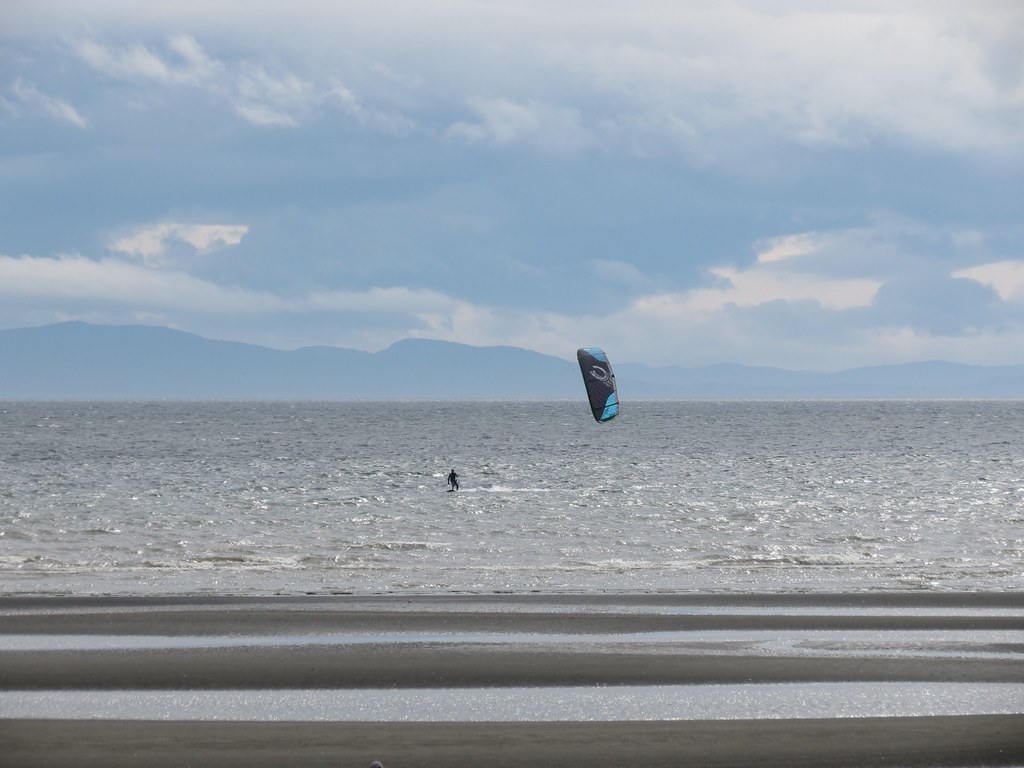
Gentle spring/summer thermal flat water cruising!
 Expert
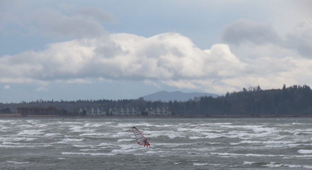
Frontal storms and coast-like waves!

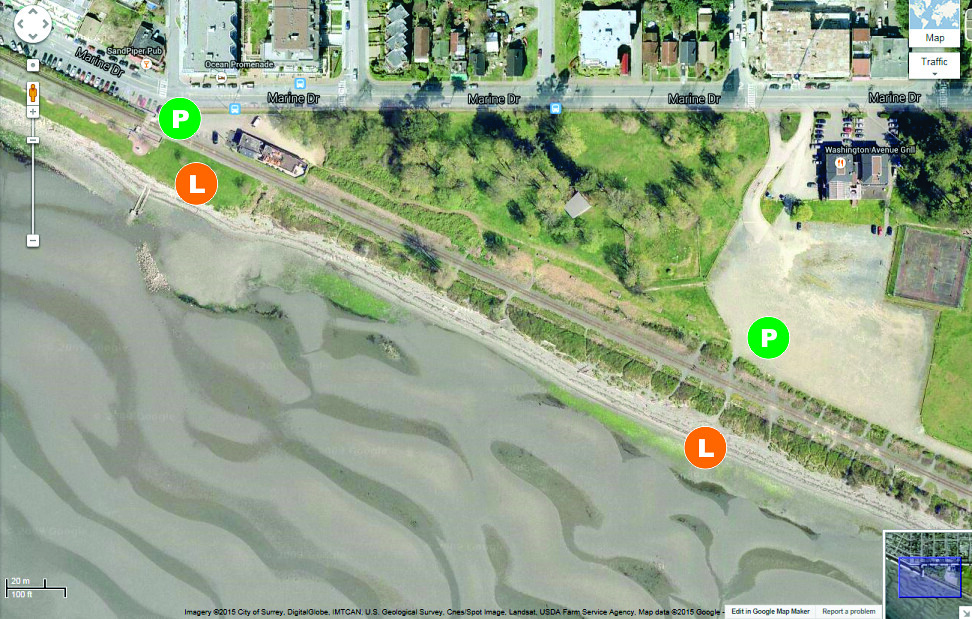
Location
https://maps.google.com/maps?q=Locust+B ... 8&t=h&z=18
Coordinates:
49.016213,-122.790002
Directions:
- south on Highway 99,
- exit 2B,
- right at stop sign on 8 Avenue,
- right to Marine Drive (first right) off the roundabout, and
- for the main launch, park on the left at the waterfront in the village of White Rock.
Parking:
There are four parking options.
- On-street (buy a ticket from blue machine – City of White Rock).
- Off-street numbered stalls (buy a ticket from the blue machine – City of White Rock).
- Off-street stalls in front of Feral Kiteboarding (buy a ticket from the machine at the south end of the parking lot).
- Off-street gravel lot on the Indian Reserve (buy a ticket from the machine – this is the cheapest option).
Seasons/Days/Strength:
- This place provides gentle spring/summer (Feb-July) light afternoon thermals on sunny days. Great conditions for big kites, big boards, no wetsuit (in summer)!
- The stronger conditions really only set up and crank a few times a year, but it is so nice it keeps you coming back.
- When the stars align this place can produce truly golden moments.
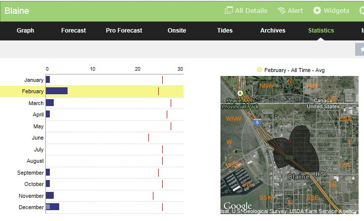
- The wind data summary above is for Blaine (which under reports for White Rock – gust line is average for White Rock – so information below has been adjusted accordingly).
- 8 months have 20 mph days.
- 1 month of the year has 25 mph days - December.
- Spring (Jan, Feb, Mar, Apr) and fall (Sep, Oct, Nov, Dec) are fairly balanced (number of days and number of strong days).
- February has the most days, but December show more days over 25 mph.
- Southeast wind dominates, but its the southwest, west and northwest days you want to catch.
- Southeast can be gusty, but the southwest through northwest bring the waves (and steadier wind).
- NW winds can loose some power coming into White Rock. For full NW wind exposure look at Acadia/Spanish Banks or Garry Point Park.
Often there can be wild swings in direction and strength that can leave sailors yelling out loud in frustration at times and in bliss at other times. In general, southeast wind is the puffiest and the more it rotates to the west and northwest the steadier the wind can get (especially once it is clear of the point on southwest).
- Wind can test your patience here and prompt swearing when puffy and shifty.
- But the same day of frustration can often be rewarded with a ‘golden’ hour or two.
- Generally the wind is lighter to the north (right) of the launch and stronger to the south (left).
Conditions:
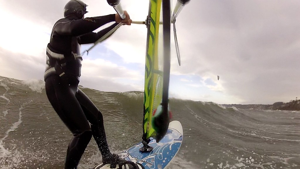
White Rock East Beach can stay fairly flat in gentler wind, but when the wind picks up it is the closest thing to a coastal wave here in the Lower Mainland (shape, speed and behaviour).
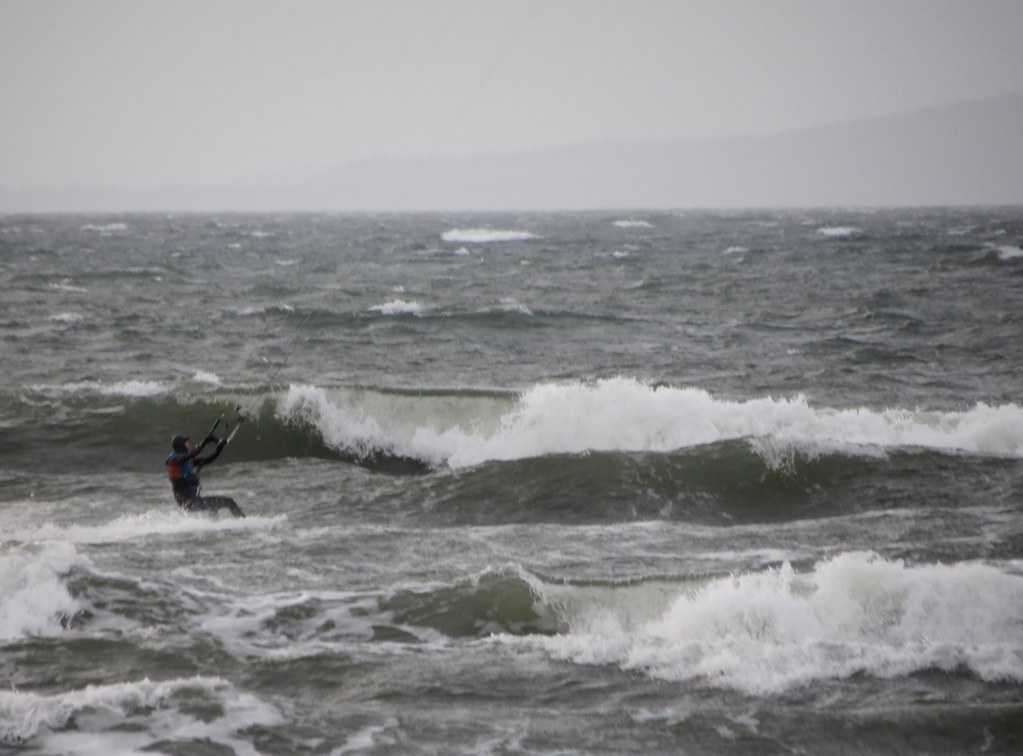
Southwest 20-30 mph (2015 Jan 18), photo credit: Michael
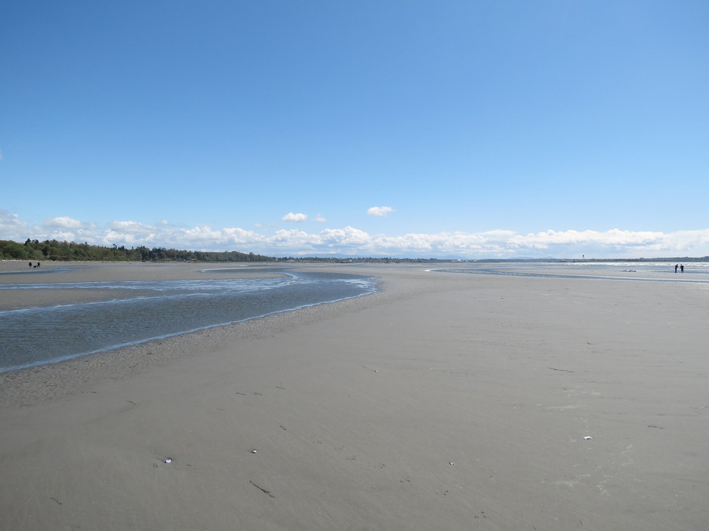
On winder days the waves are generated by the rolling swell from the deep water breaking over the shallow flat bench of sand. Mid-tide (mid-two’s to mid-three’s) seems to encourage the waves the most. When the bank is exposed (less than 1.5 M) you don't get waves, you just get rolling swell out in the deep water off the bank.
- Knee to waist high semi-organized waves growing to shoulder to over-head high on stronger wind days (if there is water over the bank).
- Larger rolling swell beyond the edge of the bank.
- Ramps favoured to port on southeast, both directions on southwest wind and starboard on northwest wind.
- When the wind is side-shore (southeast or northwest) the waves can be very closely spaced (even too close at times).
- Side-on wind allows the apparent period between waves on the way out is increased (as you are travelling further before you hit the next one) allowing you to spool up more speed and take as much air as many times as you wish (or have the strength to). This can also increase the opportunity for frontside riding as well.
Huge expanse of water running 4 km from the pier to the south edge of Semiahmoo Bay or almost 9 km from the Point to the southern edge of the bay.
Depth/Tide:
It is possible to sail at White Rock East Beach on any tide height and even low tides don’t pull the water that far away.
- <1.5 m: Medium walk (bench fully exposed).
- 2.5 m: Short walk (bench partially exposed).
- 3.5 m: Water to the shore (nice waves).
- 4+ m: No beach - pounding shore break.
On higher tides the shallow water running along the beach deepens the further you go out. On lower tides the bench exposes to reveal large expanses of sand. On south-southeast through north-northwest you will be safely blown back into shore if you have a problem.
Sweet Spot(s):
- South of the pier on southwest to west-northwest wind - the closer you get to the breakwater at the end of the pier the spicier it gets! Careful though, the wind can lighten, especially close to shore.
- Just south of the Campbell River (on a dropping mid-tide and southwest through northwest wind).
- Near the Peace Arch boarder marker (concrete monolith) on a lower tide and southwest to northwest wind.
- Light to moderate – Eel Grass
- Winter: 6/5/3 full suit with hood, boots, gloves.
- Spring/fall: 5/3 full suit, hoods, boots.
- Summer: 3/3 full suit or less.
From Marine Drive, cross the railway tracks to reach the grass lawn, take a few steps down to reach the beach (or water on a high tide).
Rigging Area:
- Grass lawn at the west launch (high tide) and sand (low tide).
- There can be some Eel Grass (weeds) at the tide line which can make launching a kite harder.
- There are usually enough people around to launch if it's windy at any tide just lots of seaweed in your lines if you self land in the water at higher or really low tides.
- Below 3.5 m tide solo launching/landing is easy as this is when the sand start to show.
- At about 3.5 m most of the sand may still be covered by water, but you can put your kite at the water and walkout .
- 4 m tide and above is hard/sketchy depending on wind direction and quantity/quality of help. Southwest wind can be straight onshore making launching particularly difficult. When this happens its worth walking kites out into the water, with help, for a safer launch. At high tide the weeds in the water can make it hard to launch even with one other person helping.
- Although the west (grass) launch is more popular the east launch, as described here, is a good option on high-tide - shallower water, smaller waves, less people and less wind shadow.
- Change rooms/washrooms at the north end of the beach.
- Restaurants within walking distance.
- Paid parking
Cautions:
- Speed limit entering the village.
- Railway tracks - always look both ways!
- Shore break on 4 m tide / storm surge
- Trees, light poles, railway tracks make launching kites tricky on high tides.
- Field of head-sizes rocks just offshore and left of the stormwater outfall.
- Concrete culvert about 100 m off the end of the storm sewer outfall at the launch.
- Old pilings just north of the river mouth.
- US border - do you have out-of-province health care coverage?
Tips:
- If you see wind pattern on the Campbell River as you drive into town, you are in for a good day.
- Parking is cheapest at gravel lot on the Indian Reserve (a good option for long sessions).
- Parking in town is more convenience (closer to the water).
- Sail north of the launch (and enjoy the waves) if overpowered.
- Sail down by the river if underpowered.
When to go:
- Southwest through northwest (if sailors are getting blown off the water at Acadia).
- Check actual wind direction and speed at Boundary Bay Airport or use Blaine sensor as a proxy (gusting over 20, time to go).
White Rock pier webcam
White Rock web cam
Boundary Bay Airport
Blaine sensor
Pictures and Videos
Unless noted otherwise, all pictures used and referenced in this post are by C36 (all rights reserved).
Gentle spring/summer thermal flat water cruising!
South 15 mph on a low-2 m tide (2013 Apr 27)
Frontal storms and coast-like waves!
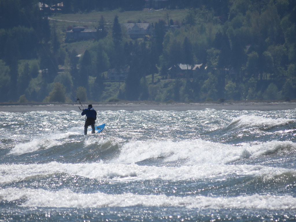
Southwest 20 mph on a ~2 m tide (2014 Apr 27)
Southwest 25-30 mph on a mid-2 m tide (2013 March 20)
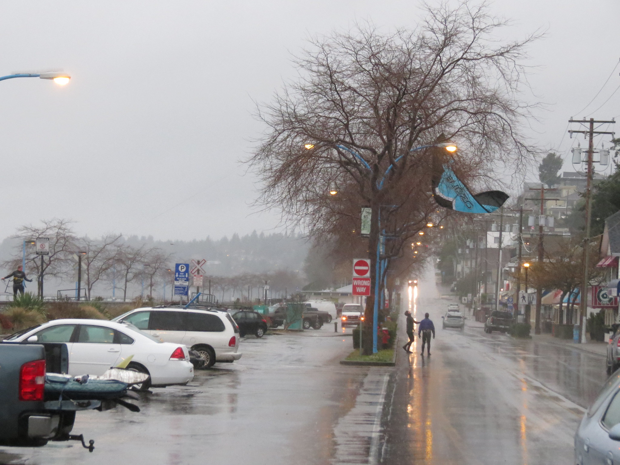
Southwest 25-30 mph on an mid-3 m tide (2015 Jan 18)
Southwest 35 mph on a mid-3 m tide (2011 Dec 25)
West 25+ mph on a 4 m dropping to 1.8 m tide (2013 Apr 29)
Northwest 40+ mph on a mid-3 m tide (2011 Nov 11)
Other Stuff
First Discovered By:
Lore and Legend:
Disclaimer
Every sailor is responsible for sailing safely, including checking local conditions first hand, choosing appropriate gear and sailing within their ability. Have fun, sail safe!
Thanks
BradR encouraged the windsurfing community to try this spot a few years back and we are thankful to him for doing so. He knows this spot really well and has graciously shared his knowledge with us. Tweegser for the addition of the spring-summer thermals and tide info. Patrick for 3.5 m tide kite launching info.
Updates
If you see anything that should be corrected or you have information that you think should be added, please post it to this thread and we will update the main post. Thanks.
\edit (2015 Feb 23): GoPro shot and photo credit added to "Water", "Conditions" section.
\edit (2015 Sep 4): More detail added to "Launching" section for kites at 3.5 m and 4+ m tides.
\edit (2015 Dec 21): Reference and link to Tweegster's description added for east launch on high tide
\edit (2016 Sept 15): White Rock pier webcam link added
/edit (2020 Nov 4): parking info updated


