Saturday SE clocking W
Awesome vid, Tony! Great vibes. The strapless cruising seems so effortless and fluid - might have to get into this kiting business at some point 

- AdrienGrelon
- Posts: 1062
- Joined: Mon Dec 09, 2013 3:17 pm
Lowesdown wrote:I had a great session, I arrived at 7:30 and started unloading and rigging at Centennial. By 8:00 moved my vehicle around and waited for it to build. I started on my 5.7/111L but as it built had to switch to my 4.6/111L. I made some serious progression today, in the straps both ways, a few water starts, and caught lots of air. Some of which while completely disconnected from my rig
Big thanks goes out to
Brad R - for encouraging me to try out this sport
Chris Klohn - for hooking me up with some sweet gear
Michael - for the great tips in the water, regarding water-starts
Adrien - for the undying amount of stoke!
Here is a quick little video of my day:
Here are a few photos from the day also:
https://www.flickr.com/photos/lowesmedia/sets/72157651340522332/
Wicked vid and progress Scott. Stoked the gear is still working well for you.
Cheers,
Chris
- Chris Klohn
- Posts: 1148
- Joined: Fri Nov 01, 2013 1:49 am
Michael wrote:Nice shots Dave! That place looks great but I can see why Mike asked that question as it looks very disorganized and gnarly from the pictures. Thanks for sharing...
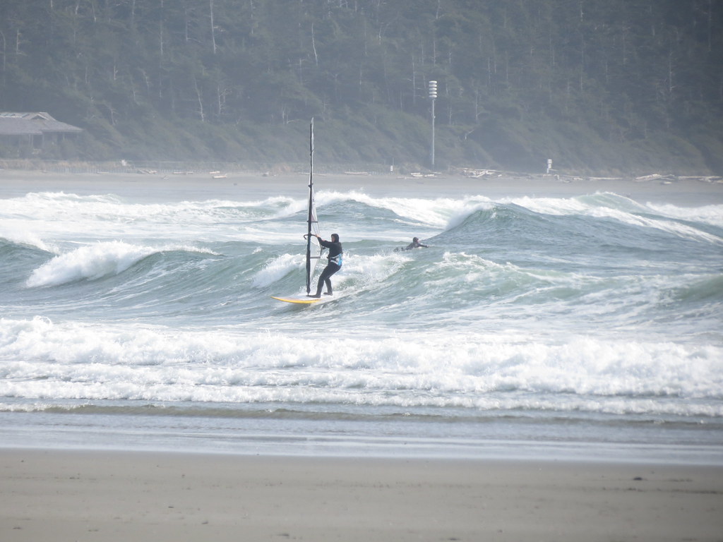
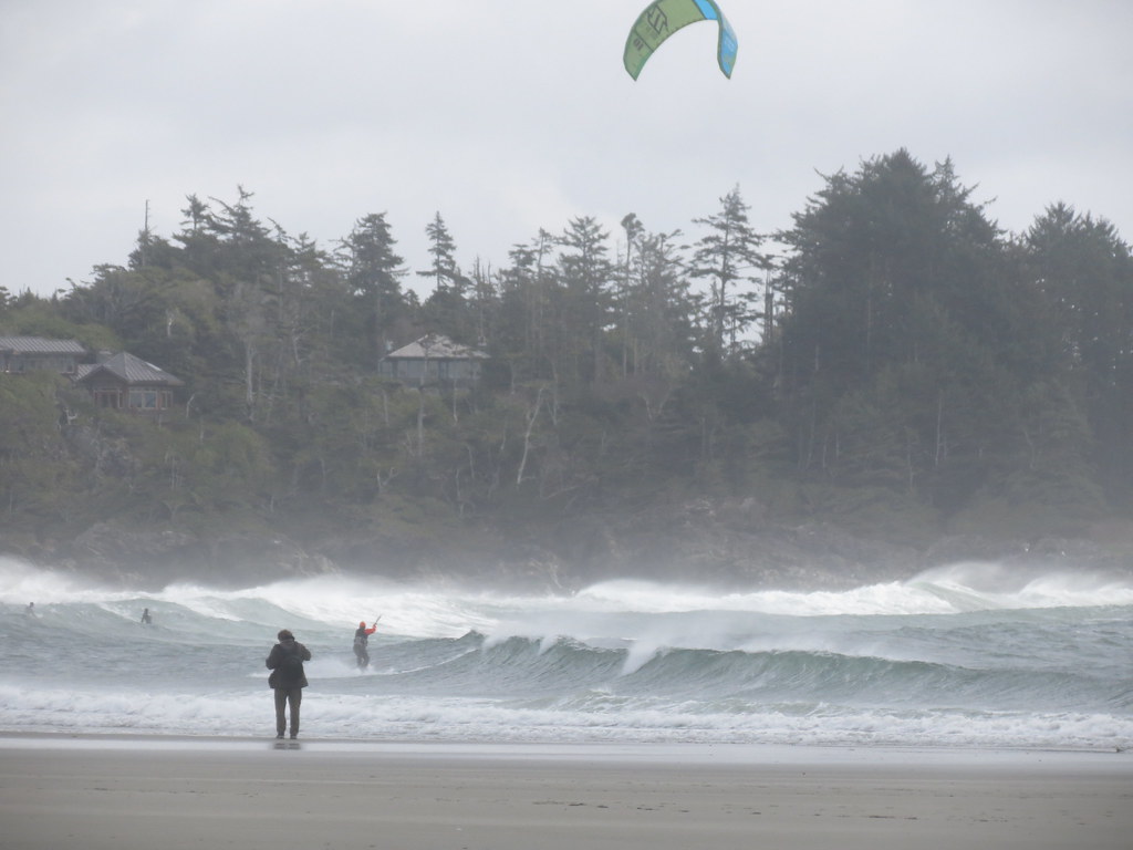
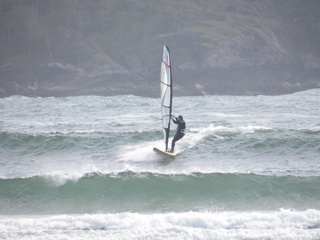
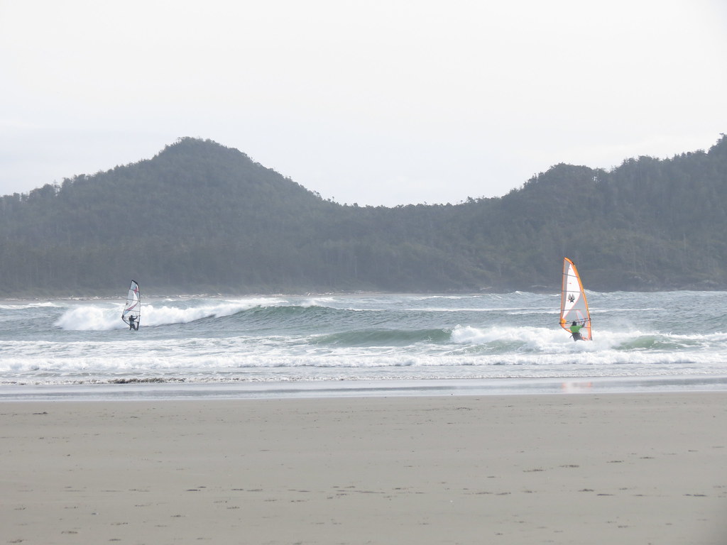
Glad you enjoyed the shots. I understand why you would get that impression - there are shots of three different beaches in the sets (Long Beach, North Chesterman and South Chesterman) included for those that recognise them for what they are on that day. The shots of 'Session 2' were taken in the mid-afternoon wind lull and the waves were a little 'peaky' - the light wind and peaky waves resulted in me taking a pass. I returned an hour later to find slightly more wind and more organized waves on the incoming tide (but no time to take pictures with premium conditions to be had). Even the shots of South Chesterman show strangely from certain angles - most of mine/Ethan's were shot from the west end or middle of the curved bay with lines of swell wrapping in an arc.
Moving from the west end of the bay:
> This one is looking along the beach to the east (wave is arching away from us)
> Here is another shot from the same spot looking along the beach - kite is riding the clean face of the wave which bends and curves away from the rider shown faintly on the lower centre right of the photo (you could ride these all the way down the beach if you caught them early enough) - note the wave in front of the one being riden (you are seeing the back side) is much larger
> This one is shot from the middle of the beach looking almost straight out to the south - first wave is reform, second is about to collapse, third is clean face (being ridden by DavidM)
> Here is another taken from the middle of the beach - you can see sailor on the left (DavidM) is approaching a wave that stretches the full width of the bay but arches away from us on the left side of the photo
I hope these descriptions are understandable. Trust me when I say the set-up was dream-like.
Here is what others (Pacific Rim frequent fliers had to say about the session):
Eastside
DavidM
HiyoSilver
Last edited by C36 on Thu Mar 26, 2015 7:10 pm, edited 3 times in total.
-

C36 - Posts: 2191
- Joined: Fri Oct 25, 2013 8:17 pm
Ya I read the session logs from BWD! Nice score, you must be thinking about moving to the Island.Trust me when I say the set-up was dream-like.
- Michael
- Posts: 2777
- Joined: Mon Oct 21, 2013 9:31 pm
Tony360 wrote:+1 for Dave/C36 getting a GoPro. I would love to see some footage of those big waves in Tofino...
Nothing like that yesterday at 3rd, but there were a few waist to chest high rollers out near the second bank.
https://vimeo.com/122251370
Great Vid Tony, Like Adrien said, it's seeing moves like that that are making me think more about getting into Kiting. I'll be shopping for a Surfboard this summer.
- Michael
- Posts: 2777
- Joined: Mon Oct 21, 2013 9:31 pm
Thanks guys! Strapless riding in waves is super fun, with a 12m and surfboard you can get out there in 12 knots so nuke winds not required. On the flip side for DTL riding the windsurf is the better craft, unless the wind/wave angle is perfect (Maui) you are pretty much one hit and done with the kite.
-

Tony360 - Posts: 330
- Joined: Fri Nov 01, 2013 11:28 am
Brad R wrote:Glad everyone got some TOW! Sweet progress Scotty, and sweet video!
I tried sailing 101 steps as I moved near there recently. Reminds me of the gorge - flat water shoulder near shore and rolling swell and jumps on the outside. No weeds is a bonus. Looking forward to trying it on different tides. Definitely a good spot for a quick dip. I'll still likely drive to the major launches when the forecast is good.
Sailed 4.7/77 from 10-12 and 5.3/93 from 12:30 to about 2:30
Long time since I've had a session so feeling grande!
Nice work on the videos Tony and Scott!
That's for the report Brad. Appreciate you sharing info, as always!
-
C36 - Posts: 2191
- Joined: Fri Oct 25, 2013 8:17 pm
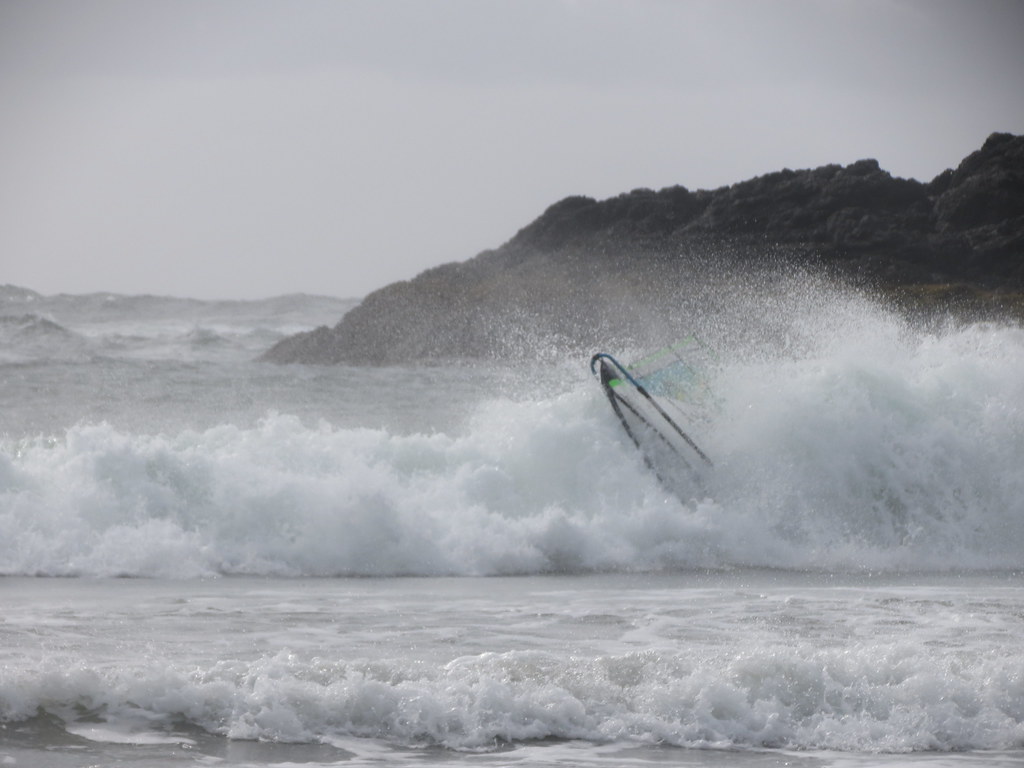
AdrienGrelon wrote:As usual, Dave is in the right place at the right time
Is this what you meant?
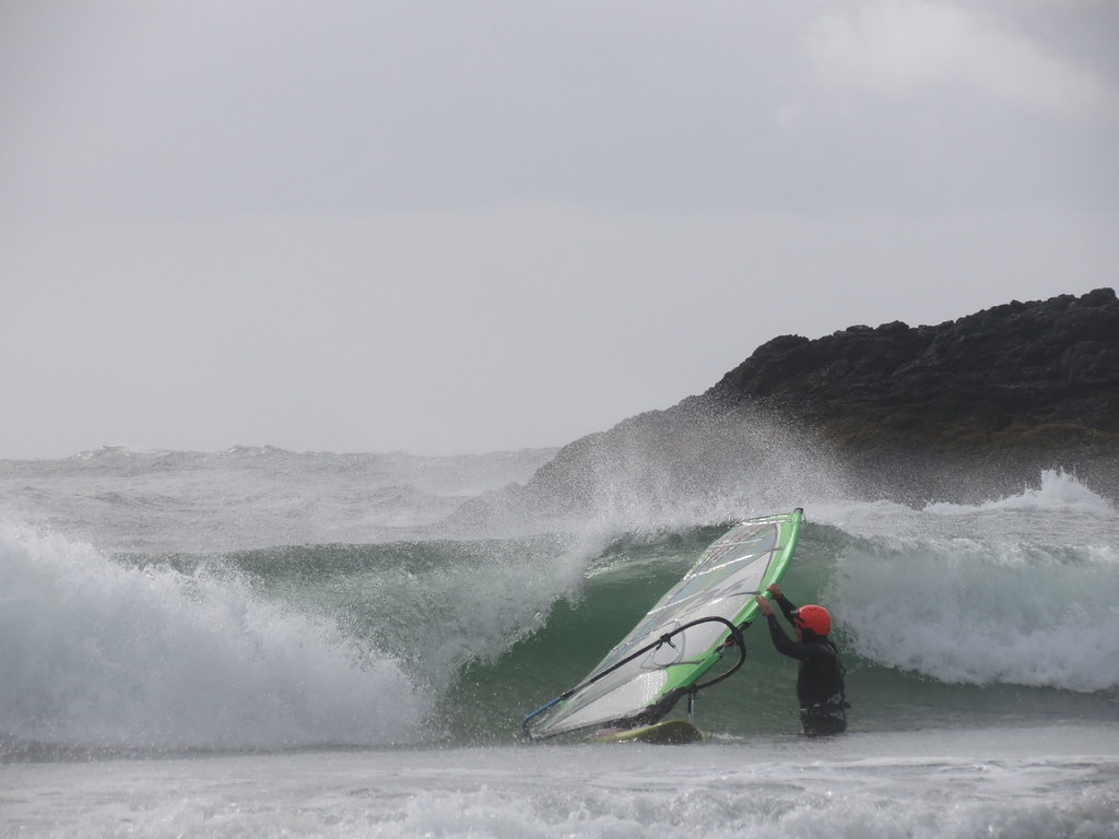
Michael wrote:...This one looks like it hurt?
It wasn't that bad and besides we had to put something in the pictures to give the waves some scale.
-
C36 - Posts: 2191
- Joined: Fri Oct 25, 2013 8:17 pm
A couple of after thoughts I figured might be worth sharing.
The first image shows how the waves curve into both North Chesterman and South Chesterman - more so for South Chesterman.
The next image shows the four different locations you can park and where I launched from (red dots). I parking at the corner at P3 so I would have access to both beaches. On March 14 the tide was a lot higher than shown in this image at 9 am and dropped about 6' to close to the level shown by about 1 pm.
I walked west as far as I could without getting to far into the wind affect in the lee of Frank Island and launched at red dot #1. Even though you were sailing across the shallow flats of the cove and there was some spacing between the waves, it was REALLY hard to work to windward and gain distance from the beach in the onshore wind and waves. But with some effort I made it to about red dot #2 (a distance of about 400 m or about twice the width of the sailing area in the Squamish River). From here the wave angle was side-onshore and made for awesome jumping to Starboard on the way back out (from memory you got a least five waves before your got to the outside). Form red dot #2 I was able to make it to the outside of the impact zone gybe off Frank Island and drive further to windward only to be eaten by an over head close-out wave while sailing clew first down-the-line on jibe exit. Humble-tumble and long swim followed to return to red dot #2.
In hindsight I should have lanched from the footpath (P2) or the change house (P1) further north along the beach. This would have made getting out WAY easier with the side-on waves and would have doubled width of the available water to about 800 m. If you washed into the pit of the bay, you could always drive down to P3, retrieve your gear and repeat.
After sailing North Chesterman solo for more than a couple of hours I decided I was going to give South Chesterman a shot even though I was more than a touch nervious about taking medium sized gear out into side-off wind into the wind shadow of Frank Island and/or getting washed downwind into the rock points off Rosie Bay which were getting hammer by some rather large waves. I figured I would minimize the risk by launching at red dot #3 and dared walk only as deep as I could stand (by this time the low tide had minimized the shallow water and size of the sailable area inside the South Chesterman. I waited for wave of choice and then waterstarted point along and into the beach. Once under the power of the wave you could drive down the line and there was time to make multiple hits before you ran out of water. Even this was so much fun I then walked up the beach and repeated another 3 times. I was satisfied enough with a couple of these rides that I then tried North Chestermans one more time, but the wind had backed to the point the 4.5/92 was no longer enough.
Hope there is something in there that helps clarify why the waves looked 'confused' in some of the pictures and might help you when sailing here for the first time.
The first image shows how the waves curve into both North Chesterman and South Chesterman - more so for South Chesterman.
- Frank Island.jpg (255.35 KiB) Viewed 13899 times
The next image shows the four different locations you can park and where I launched from (red dots). I parking at the corner at P3 so I would have access to both beaches. On March 14 the tide was a lot higher than shown in this image at 9 am and dropped about 6' to close to the level shown by about 1 pm.
- Chesterrman (N+S).jpg (1.68 MiB) Viewed 13899 times
I walked west as far as I could without getting to far into the wind affect in the lee of Frank Island and launched at red dot #1. Even though you were sailing across the shallow flats of the cove and there was some spacing between the waves, it was REALLY hard to work to windward and gain distance from the beach in the onshore wind and waves. But with some effort I made it to about red dot #2 (a distance of about 400 m or about twice the width of the sailing area in the Squamish River). From here the wave angle was side-onshore and made for awesome jumping to Starboard on the way back out (from memory you got a least five waves before your got to the outside). Form red dot #2 I was able to make it to the outside of the impact zone gybe off Frank Island and drive further to windward only to be eaten by an over head close-out wave while sailing clew first down-the-line on jibe exit. Humble-tumble and long swim followed to return to red dot #2.
In hindsight I should have lanched from the footpath (P2) or the change house (P1) further north along the beach. This would have made getting out WAY easier with the side-on waves and would have doubled width of the available water to about 800 m. If you washed into the pit of the bay, you could always drive down to P3, retrieve your gear and repeat.
After sailing North Chesterman solo for more than a couple of hours I decided I was going to give South Chesterman a shot even though I was more than a touch nervious about taking medium sized gear out into side-off wind into the wind shadow of Frank Island and/or getting washed downwind into the rock points off Rosie Bay which were getting hammer by some rather large waves.
Hope there is something in there that helps clarify why the waves looked 'confused' in some of the pictures and might help you when sailing here for the first time.
-
C36 - Posts: 2191
- Joined: Fri Oct 25, 2013 8:17 pm
One of the beach regulars sent me some shots from last saturday afternoon in WR (after Mark left
)
- Darren being generally awesome
- 11086914_10153047022305795_2022794358_o.jpg (203.44 KiB) Viewed 13870 times
- Attachments
-
- Ryan
- 11086374_10153047007955795_1000775797_o.jpg (188.53 KiB) Viewed 13870 times
-
- No style points
- 11033880_10153046973680795_1954696923217039973_o.jpg (251.08 KiB) Viewed 13870 times
-
- Brad on the T-rex
- 11075513_10153046981930795_586141191_o.jpg (182.84 KiB) Viewed 13870 times
-
- 11086782_10153047018505795_219352929_o.jpg (485.71 KiB) Viewed 13870 times
-
- Ryan, Darren & Myself
- 11074681_10153047020890795_635671753_o.jpg (362.2 KiB) Viewed 13870 times
-

tweegster - Posts: 662
- Joined: Sat Nov 29, 2014 3:32 pm